


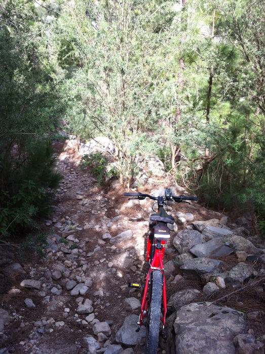
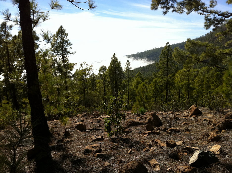
From Vilaflor, follow TF21 uphill for a couple of switchbacks until taking a right turn into the pine forest. A good dirt track (closed for cars) takes you gently uphill to the 'Lunar Landscape' at around 1700m, then down to around 1450m to the Barranco del Rio. There, the road stops, and I carried the bike down a small footpath on the right hand side to cross the river at the bottom of the gorge; then up on the other side again to join another forest road. From there, it's gently uphill, with great views over the island's East coast. At 1900m, make a left turn onto a track that takes you up to the rim. The track is a bit bumpy, and I needed to push the bike for parts of it. The rim is reached at 2300m. From there, the track beautifully coasts along the rim, with great views on both sides.
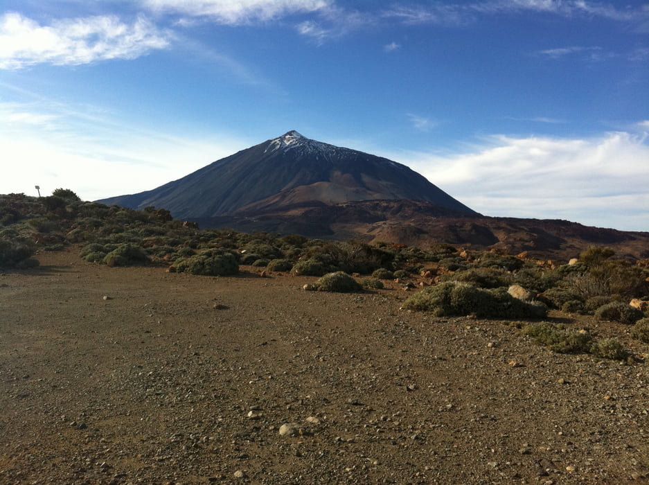
At the most North-East corner of this track, you're still at 2300m. You get a view of the observatorium, and the track joins TF-24 down to the El Portillo visitor centre at 2080m. From there, I took TF-21 (the main road through the Teide-park) back to the South-West exit at Boca Tauce. Traffic is relatively light, and the road rises slowly to around 2370m shortly before the bottom station of the cable-car. From there, it is mostly downhill back to Vilaflor, however, with a notable final ascent from the Llano de Ucanca (~2030m) to a vista point at Los Retamares (2200m). To save time (as it was getting dark and cold) I took the TF-21 back down to Vilaflor - this part of the TF-21 is almost absurdly wide and fast. I'm not sure what variations there are that are more adequate for a mountain-bike.
Remember to take along enough water. When I was there (3 Jan 2011), there was water in the Barranco del Rio; and water can be purchased at the restaurant in El Portillo.
I used the "Tenerife Holiday Map" from Kuemmerly+Frey.
Galleria itinerari
Mappa itinerario e altimetria
Altezza minima 1347 m
Altezza massima 2374 m
Maggiori informazioni sull'autore del tour

|
WolfgangHuber |
Commenti

The tour starts and ends in Vilaflor, at 1450m, 20km from Los Cristianos. I went there by car; if you go to the start place by bus, you could add another long downhill to the coast at the end.
Tracce GPS
Punti di traccia-
GPX / Garmin Map Source (gpx) download
-
TCX / Garmin Training Center® (tcx) download
-
CRS / Garmin Training Center® (crs) download
-
Google Earth (kml) download
-
G7ToWin (g7t) download
-
TTQV (trk) download
-
Overlay (ovl) download
-
Fugawi (txt) download
-
Kompass (DAV) Track (tk) download
-
Scheda tecnica (pdf) download
-
File originale dell'autore (gpx) download
Maggiori informazioni sull'autore del tour
|
|
WolfgangHuber |
Aggiungi ai miei preferiti
Rimuovi dai miei preferiti
Modifica dei tag
Tour aperto
Il mio voto
Vota