


Date: April 23, 2011
Start: 1204 m (mountain station of Salamander Sesselbahn)
Finish: 872 m (lower station of Salamander Sesselbahn)
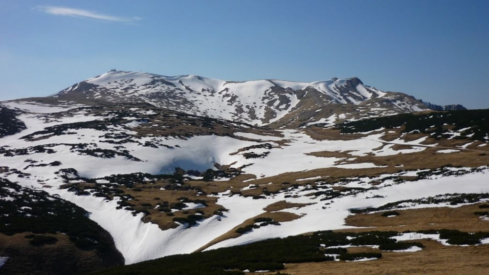
Highest point: 2047 m
Lowest point: 872 m
Total ascent: 1189 m
Total descent: 1521 m
Information about the Salamander Sesselbahn:
http://www.schneebergbahn.at
Webcams:
http://www.schneeberg.tv
Ulteriori informazioni sotto
http://www.beepee.hu/v/turak/schneeberg1104/Galleria itinerari


Mappa itinerario e altimetria
Altezza minima 873 m
Altezza massima 2048 m
Maggiori informazioni sull'autore del tour
|
|
beepee |
Commenti

Another nice tour on and around Schneeberg.
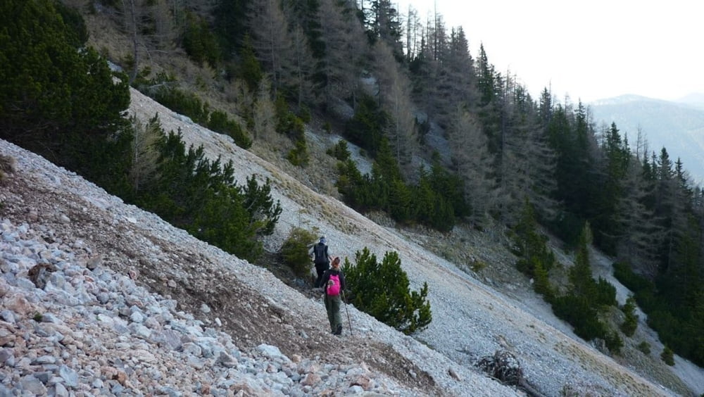
Up via Fadensteig to Fischerhütte.
Down from Fischerhütte by Damböckhaus to the mountain station of the Salamander Railway, then down towards Baumgartner Station. Right before Baumgartner, head towards Nördlicher Grafensteig. Follow the trail, then turn right towards Losenheim (instead of going straight to Edelweisshütte). The last few kms are in a forest, then on a dirt road.
Between the mountain station of Salamander Railway and Baumgartner Station, there is also a shorter route, marked with yellow. You can take it, instead of going on the longer route like we did. Look at the map and it will be clear...
Please start the tour earlier than we did, or go much faster. We started at 10:40, and finished at 21:35, ending up in a hurry on Nördlicher Grafenstaig, to reach the end of the rocky area before sunset, and walking the last hour with headlights.
Tracce GPS
Punti di traccia-
GPX / Garmin Map Source (gpx) download
-
TCX / Garmin Training Center® (tcx) download
-
CRS / Garmin Training Center® (crs) download
-
Google Earth (kml) download
-
G7ToWin (g7t) download
-
TTQV (trk) download
-
Overlay (ovl) download
-
Fugawi (txt) download
-
Kompass (DAV) Track (tk) download
-
Scheda tecnica (pdf) download
-
File originale dell'autore (gpx) download
Maggiori informazioni sull'autore del tour
|
|
beepee |
Aggiungi ai miei preferiti
Rimuovi dai miei preferiti
Modifica dei tag
Tour aperto
Il mio voto
Vota