
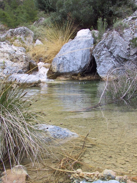

If you ever go during summer to the south of spain you think that hiking out in the campo is impossible due to the heat. For the majority of places this could be said. The Valle of Rio Verde is an exception from the rule. Note only is the valley descending directly into the Mediterranean Sea but also carries all year around plenty of water. As the name Rio Verde suggests the water is really green! .. really really green. Of course that is mostly due to the geological structures/rocks chalk, launa ...
Back in the medieval days the used that river for transporting wood down to the settlements on the ocean and they kept doing this until mid of last century i think. You can still see the marks on the rocks from the transport. Also the path leading from the coast up over the Sierra de Guajar/Cazulas to Granada was used to carry fish on mules in a daytrip.
Nowadays the valle del rio verde is known to some people for canoying which is quite fun but also a little sad because of damaging the delicate structure of the riverbed. there are really enough deep and big pools to jump in i think the largest was maybe 5 meter deep and at least an radius of 8m. The base for jumping another 10 meters up. What could you want more in summer.
If you are thinking that you can walk the valley down without getting wet - no no no! You have to cross the river at least 2-3 times and there maybe no bridge or whatever. The river can really swell up in spring and take everything with it.
This trip is the perfect beach or city summer getaway. there a 2 options.
1) One-way
On this option you start from the top and walk all the way down and in the end up to the road to either hitchhike or have somebody pick you up (or with 2 cars). walking the road up again would be a bad choice.
2) Round-way
There is actually only one round trip option which i tried before (without gps) and for that you will stay in the upper part of the rio verde and take a diversion in direction of the embalse
Dont trust the statistics. My Batteries of the GPS ran out in the end so i had to redraw the track with the result that some trackpoints dont have the right values. its a good 8 hour walk and maybe 18km.
Have fun
Mappa itinerario e altimetria
Altezza minima 428 m
Altezza massima 1157 m
Maggiori informazioni sull'autore del tour
|
|
anda-en-lucia |
Commenti

There is a bus that is suppose to go from granada to otivar and back.
Tracce GPS
Punti di traccia-
GPX / Garmin Map Source (gpx) download
-
TCX / Garmin Training Center® (tcx) download
-
CRS / Garmin Training Center® (crs) download
-
Google Earth (kml) download
-
G7ToWin (g7t) download
-
TTQV (trk) download
-
Overlay (ovl) download
-
Fugawi (txt) download
-
Kompass (DAV) Track (tk) download
-
Scheda tecnica (pdf) download
-
File originale dell'autore (gpx) download
Maggiori informazioni sull'autore del tour
|
|
anda-en-lucia |
Aggiungi ai miei preferiti
Rimuovi dai miei preferiti
Modifica dei tag
Tour aperto
Il mio voto
Vota