Accesso

Hai dimenticato il login?

I cookie devono essere accettati!
La funzione cookie del suo browser è disattivata. Si prega di attivare la funzione.

Non sei ancora membro?

Registrati ora
Accesso

Possibile solo per gli utenti registrati

Effettua il login per poter utilizzare questa funzione.

Hai dimenticato il login?

I cookie devono essere accettati!
La funzione cookie del suo browser è disattivata. Si prega di attivare la funzione.

Non sei ancora membro?

Registrati ora
Filtro
Categorie
Filtri avanzati
  • Lunghezza (km)
  • Dislivello
Memorizza filtro Azzera il filtro

TrackRank

QRCode

Dati tecnici

Lunghezza44,8 km Dislivello0 m Discesa0 m Durata04:00 h:m Data11.08.2011
Valutazioni Autore Paesaggio Divertimento Condizione Tecnica

Statistica

273 Visualizzazioni Valutazioni 64 Download Media
Vota
  • Scheda tecnica
  • Come arrivare
  • Download

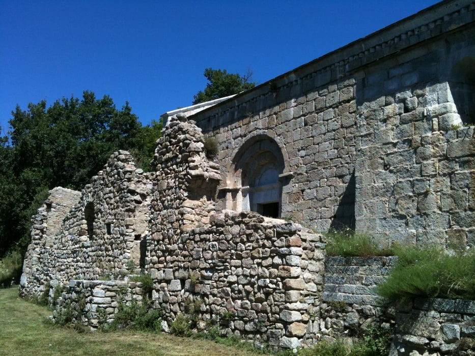
The uphill is on a paved road, just the last 2km are unpaved. The "Église Saint-Martin de Corsavy" just before reaching the village of Corsavy is definitely worth a stop. Before leaving the paved road towards the Tour de Batere you can cycle on westwards for 500m to take a rest in the "Refuge de Batère" (1450m), the food was excellent.

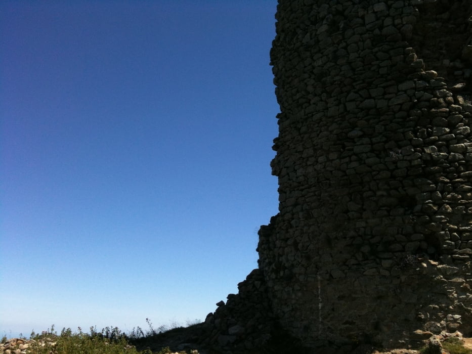
The top of the tour is marked by an old stone signaltower (Tour de Batère) , the view is stunning!!!!

From there you go down on unpaved, old miner's roads. Ever thought your bike's suspension parts are good? Well, if they survive the first part of the downhill, they really are. Nevertheless, the downhill is bumpy, but not difficult. You pass old mines and end up in Amelie les bains.

If you want, there are a few options to do the downhill on singletrails (hiking trails marked with a yellow stripe), but be warned: the trails are washed out and rocky, I don't recommend them.
 

Galleria itinerari

Mappa itinerario e altimetria

  • Open Street Map
  • Google
Altezza minima 99999 m Altezza massima -99999 m Vista dettagliata

Maggiori informazioni sull'autore del tour

DonSegafredo
Membro dal 2011

Invia un messaggio privato

Commenti

If you're coming from Ceret just drive through Amelie les bains and stop on the parking lot outside of amelie les bains. It's free and that's, where this gps-track starts from.

Tracce GPS

Punti di traccia
  • GPX / Garmin Map Source (gpx) download
  • TCX / Garmin Training Center® (tcx) download
  • CRS / Garmin Training Center® (crs) download
  • Google Earth (kml) download
  • G7ToWin (g7t) download
  • TTQV (trk) download
  • Overlay (ovl) download
  • Fugawi (txt) download
  • Kompass (DAV) Track (tk) download
  • Scheda tecnica (pdf) download
  • File originale dell'autore (gpx) download

Maggiori informazioni sull'autore del tour

DonSegafredo
Membro dal 2011

Invia un messaggio privato
Share track
Aggiungi ai miei preferiti
Rimuovi dai miei preferiti
Modifica dei tag
Il mio voto
Vota
Itinerario: Up to the tower
Tipo: Mountain bike
Lunghezza: 44,8 km
Valutato su:
Durata:
Giorni/Diurni
Ora/Ore
Minuti
Valutazione: Paesaggio Divertimento Condizione Tecnica