Accesso

Hai dimenticato il login?

I cookie devono essere accettati!
La funzione cookie del suo browser è disattivata. Si prega di attivare la funzione.

Non sei ancora membro?

Registrati ora
Accesso

Possibile solo per gli utenti registrati

Effettua il login per poter utilizzare questa funzione.

Hai dimenticato il login?

I cookie devono essere accettati!
La funzione cookie del suo browser è disattivata. Si prega di attivare la funzione.

Non sei ancora membro?

Registrati ora
Filtro
Categorie
Filtri avanzati
  • Lunghezza (km)
  • Dislivello
Memorizza filtro Azzera il filtro

TrackRank

QRCode

Dati tecnici

Lunghezza27,0 km Dislivello0 m Discesa0 m Durata02:30 h:m Data14.08.2011
Valutazioni Autore Paesaggio Divertimento Condizione Tecnica

Statistica

569 Visualizzazioni Valutazioni 48 Download Media
Vota
  • Scheda tecnica
  • Come arrivare
  • Download

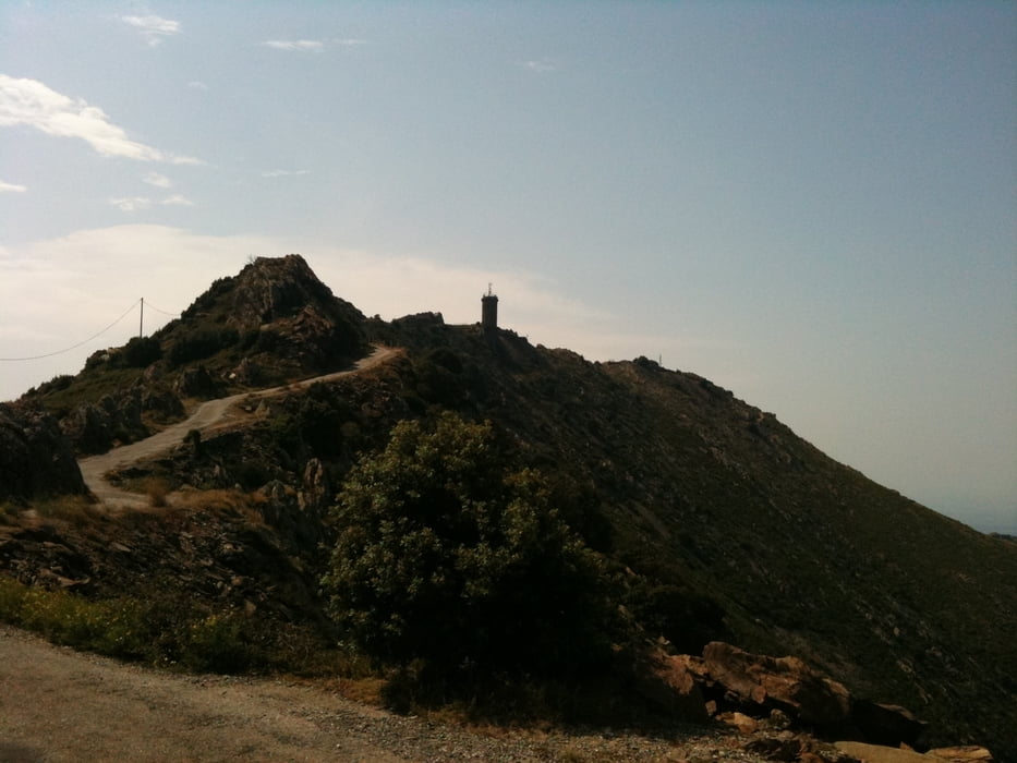
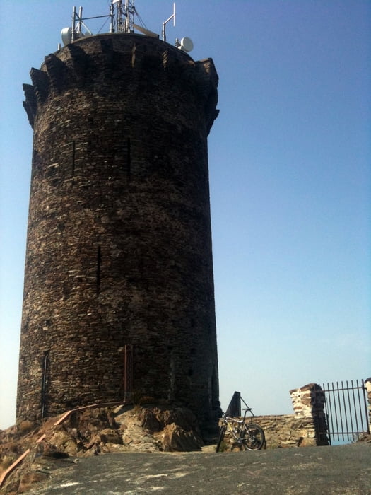
This tour takes you up to the Tour de Madeloc, where from you have a stunning view towards both the mountains and the coast. As soon as you left behind the crowded main road from Argeles you climb up a quiet paved road (D86), which in the first part is shady in the second part is unbelievably hot, when the sun is shining. Bring enough water, as there is no fountain or shop! You'll end up at the last uphil towards the tower, which is forbidden for cars, motorbikes,... The climb is incredibly steep and I confess: it was just my ego which prevented me from walking the rest instead of doing it on the bike. But the view from the top compensates for every drop of sweat you lost.

I went the same way back to Argeles, but you could also follow the D86 down to Banyuls sur mer. I saw also an unpaved road/singletrail starting at the summit, but I didn't do it. If anyone does, please post your experiences here!

Galleria itinerari

Mappa itinerario e altimetria

  • Open Street Map
  • Google
Altezza minima 99999 m Altezza massima -99999 m Vista dettagliata

Maggiori informazioni sull'autore del tour

DonSegafredo
Membro dal 2011

Invia un messaggio privato

Commenti

Start at the southern beach of Argeles; there is a parking lot too (2.60 Euro/day at the time of writing)

Tracce GPS

Punti di traccia
  • GPX / Garmin Map Source (gpx) download
  • TCX / Garmin Training Center® (tcx) download
  • CRS / Garmin Training Center® (crs) download
  • Google Earth (kml) download
  • G7ToWin (g7t) download
  • TTQV (trk) download
  • Overlay (ovl) download
  • Fugawi (txt) download
  • Kompass (DAV) Track (tk) download
  • Scheda tecnica (pdf) download
  • File originale dell'autore (gpx) download

Maggiori informazioni sull'autore del tour

DonSegafredo
Membro dal 2011

Invia un messaggio privato
Share track
Aggiungi ai miei preferiti
Rimuovi dai miei preferiti
Modifica dei tag
Il mio voto
Vota
Itinerario: Up to the "Tour de Madeloc"
Tipo: Bicicletta da corsa
Lunghezza: 27,0 km
Valutato su:
Durata:
Giorni/Diurni
Ora/Ore
Minuti
Valutazione: Paesaggio Divertimento Condizione Tecnica