


Date: July 31, 2011
Start: 2488 m (Adolf Nossberger Hütte)
Finish: 2508 m (Wangenitzseehütte)
Highest point: 2810 m (Kreuzseescharte)
Lowest point: 2488 m (Adolf Nossberger Hütte)
Total ascent: 672 m
Total descent: 634 m
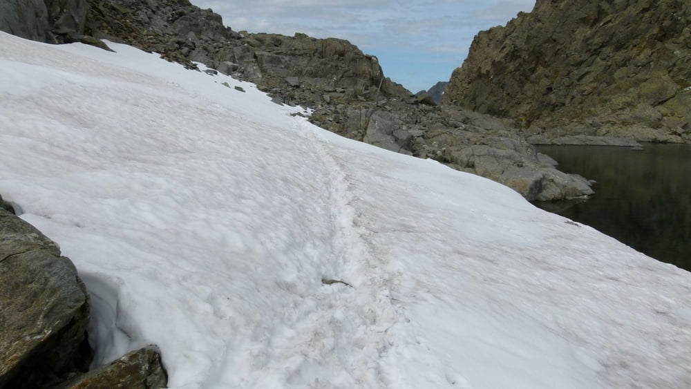
Part of the trail is marked 'black', which requires absolutely steady feet and no fear of height at all!! Be very careful!
Most of the trail is quite steep going up and down as well.
**************************
Do not take anything, do not leave anything!
**************************
Please, do NOT leave trash behind. Paper tissues are also trash! Chocolate wrap as well. Bring a small trash bag with you and take your trash with yourself to the next trash can. It is not that heavy.
**************************
Ulteriori informazioni sotto
https://picasaweb.google.com/beatahardi/2010073008013NaposHutteTura?authuser=0&feat=directlinkGalleria itinerari


Mappa itinerario e altimetria
Altezza minima 2476 m
Altezza massima 2804 m
Maggiori informazioni sull'autore del tour
|
|
beepee |
Commenti

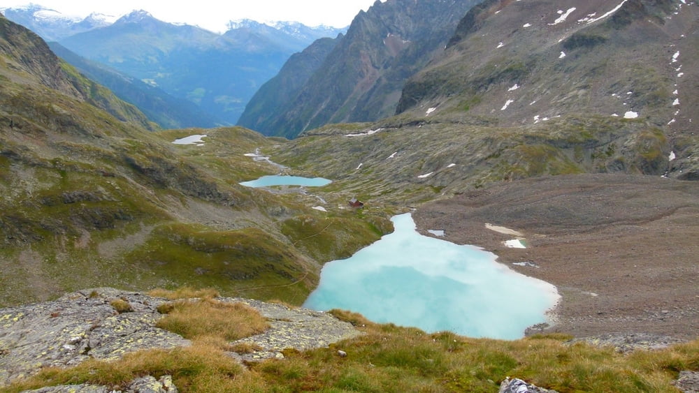
Places where you can eat and drink:
Adolf Nossberger Hütte
Wangenitzseehütte
Route:
1. from Adolf Nossberger Hütte, follow the signs towards Niedere Gradenscharte (alternative: Höhere Gradenscharte, but you will need climbing equipment - Kletterset - for that one)
2. climb up the rocks from the Hütte towards Niedere Gradenscharte, do not turn towards Keeskopf
3. from Niedere Gradenscharte, follow the trail towards Wangenitzseehütte or Lienzer Hütte. There will be a short secured trail after the Scharte, very steep, you will need to climb down holding on to pre-installed iron rails.
4. when you reach a crossing, follow the trail to Wangenitzseehütte
5. there will be several secured places where you can use the pre-installed iron steps and rails
6. after merging with the trail coming from Höhere Gradenscharte, you will soon reach Kreuzseescharte. From here, you can already see the goal: Wangenitzseehütte.
7. walk down the trail to Wangenitzseehütte, you can greet some nice lambs on the way
Make sure to bring plenty of water!!!
**************************
Do not take anything, do not leave anything!
**************************
Please, do NOT leave trash behind. Paper tissues are also trash! Chocolate wrap as well. Bring a small trash bag with you and take your trash with yourself to the next trash can. It is not that heavy.
**************************
Tracce GPS
Punti di traccia-
GPX / Garmin Map Source (gpx) download
-
TCX / Garmin Training Center® (tcx) download
-
CRS / Garmin Training Center® (crs) download
-
Google Earth (kml) download
-
G7ToWin (g7t) download
-
TTQV (trk) download
-
Overlay (ovl) download
-
Fugawi (txt) download
-
Kompass (DAV) Track (tk) download
-
Scheda tecnica (pdf) download
-
File originale dell'autore (gpx) download
Maggiori informazioni sull'autore del tour
|
|
beepee |
Aggiungi ai miei preferiti
Rimuovi dai miei preferiti
Modifica dei tag
Tour aperto
Il mio voto
Vota