

Hikers and photographers almost fight for permits to visit the magnificent and famous formations in Coyote Buttes. A permit to go CBSouth is a ticket to adventure, featuring an exciting drive on remote roads of an untrailed wilderness. The Bureau of Land Management issues permits for twenty individuals per day. Access is by remote high-clearance, four-wheel drive roads. There are no hiking trails or routes once you get there.
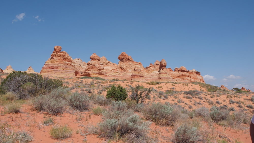
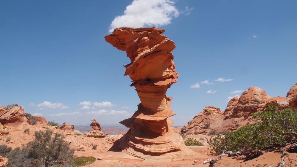
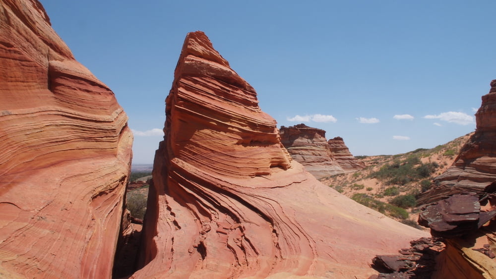
The teepee is the most common formation in Coyote Butte South.
The coloration of the formations is also quite unusual, featuring a strong yellow color, with typical variations of red or brown.
There are no facilities. You must bring in your own water and pack out all your trash.
The teepee is the most common formation in Coyote Butte South.
The coloration of the formations is also quite unusual, featuring a strong yellow color, with typical variations of red or brown.
There are no facilities. You must bring in your own water and pack out all your trash.
Fotogalerie van de tocht


Kaart en hoogteprofiel van de tocht
Minimumhoogte 1719 m
Maximale hoogte 1884 m
Meer over de tour auteur

|
willydn |
Commentaren

From Kanab, drive 40 miles east on Highway 89.
Turn onto House Rock Valley Road on the right side of the road, located between mile markers 25 and 26. Drive another 20.7 miles on House Rock Valley Road, turn left on BLM1017(Pine Tree Road) Road access by BLM1017 - BLM1066 - BLM1081 - BLM1082 into Coyote Buttes South. The route to Cottonwood Cove is about twelve miles from House Rock Valley Road.
After the first easy road BLM-1017, things get a little bit more difficult. The remaining roads are definitely four-wheel drive and high-clearance.
A couple of mile before reaching Cottonwood Cove, we pass through Poverty Flat.(ruins of an old ranch) Just north of the buildings there is an old windmill.
From the parking area at Cottonwood Cove, the Cottonwood Teepees and other sandstone attractions are about a half-mile walk to the west.
GPS-tracks
Trackpoints-
GPX / Garmin Map Source (gpx) download
-
TCX / Garmin Training Center® (tcx) download
-
CRS / Garmin Training Center® (crs) download
-
Google Earth (kml) download
-
G7ToWin (g7t) download
-
TTQV (trk) download
-
Overlay (ovl) download
-
Fugawi (txt) download
-
Kompass (DAV) Track (tk) download
-
Pagina van de tocht (pdf) download
-
Origineel dossier van de auteur (gpx) download
Meer over de tour auteur
|
|
willydn |
Toevoegen aan mijn favorieten
Uit mijn favorieten verwijderen
Tags bewerken
Open track
Mijn waardering
Tarief