Inloggen

Login vergeten?

Cookies moeten worden aanvaard!
De cookiefunctie van uw browser is gedeactiveerd. Activeer de functie.

Ben je nog geen lid?

Registreer nu
Inloggen

Alleen mogelijk voor ingelogde gebruikers

Log in om deze functie te kunnen gebruiken.

Login vergeten?

Cookies moeten worden aanvaard!
De cookiefunctie van uw browser is gedeactiveerd. Activeer de functie.

Ben je nog geen lid?

Registreer nu
Filter
Categorieën
Geavanceerde filters
  • Lengte (km)
  • Hoogtemeter
Filter opslaan Filter resetten

TrackRank

QRCode

Technische gegevens

Lengte23,0 km Hoogtemeter0 m Afdaling0 m Duur02:00 h:m Datum30.08.2012
Beoordelingen Auteur Landschap Funfactor Conditie Techniek

Statistiek

183 Views Beoordelingen 9 Downloads Gemiddelde
Tarief
  • Pagina van de tocht
  • Route
  • Downloads

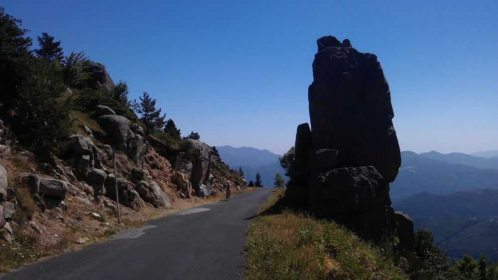
The first part of the uphill is quite steep and on sunny days you will be "kissed by the flame". The partially ruined "Église Saint-Martin de Corsavy" just before reaching the village of Corsavy is definitely worth a stop. In Corsavy refill your bottles at the fountain in the center, this will be your last chance to do so until you reach the Refuge de Batère. After Corsavy the road goes almost flat northward for some km's (nice to prepare for the final uphill).  After passing abandoned old mines and miner's homes you'll finally reach the "Refuge de Batère" (1450m) - enjoy a well earned rest up there (btw: the food is excellent).

If you want you can take a short hike on an unpaved road to the Tour the Batère (the old stone tower you've seen just before reaching the Refuge). The view from this old stone signaltower is stunning (look for other towers in sight, witch which the Tour the Batère was communicating in the past).

Kaart en hoogteprofiel van de tocht

  • Open Street Map
  • Google
Minimumhoogte 99999 m Maximale hoogte -99999 m Detailweergave

Meer over de tour auteur

DonSegafredo
Lid sinds 2011

Stuur een privébericht

Commentaren

Start west of Arles sur Tech, where the D43 begins. If you came by car, you'll find some place to park there.

GPS-tracks

Trackpoints
  • GPX / Garmin Map Source (gpx) download
  • TCX / Garmin Training Center® (tcx) download
  • CRS / Garmin Training Center® (crs) download
  • Google Earth (kml) download
  • G7ToWin (g7t) download
  • TTQV (trk) download
  • Overlay (ovl) download
  • Fugawi (txt) download
  • Kompass (DAV) Track (tk) download
  • Pagina van de tocht (pdf) download
  • Origineel dossier van de auteur (gpx) download

Meer over de tour auteur

DonSegafredo
Lid sinds 2011

Stuur een privébericht
Share track
Toevoegen aan mijn favorieten
Uit mijn favorieten verwijderen
Tags bewerken
Mijn waardering
Tarief
Tocht: To the Refuge de Batère
Type: Racefiets
Lengte: 23,0 km
Evaluated on:
Duur:
Dagen
Uurtjes
Minuten
Beoordeling: Landschap Funfactor Conditie Techniek