
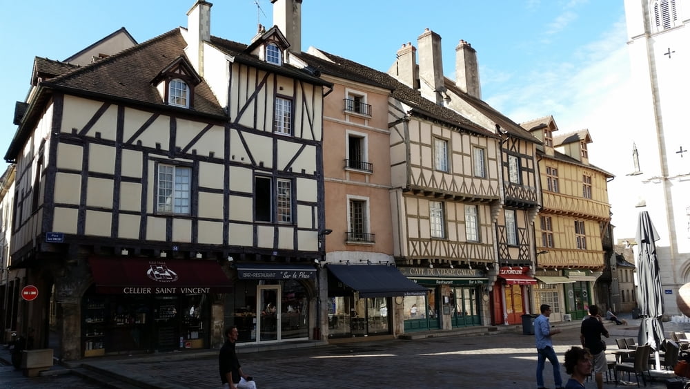

If you´re spending vacation in Burgundy, don´t miss a trip to Chalon sur Saone. This is a small city next to the river Saone, with interesting landscapes and architecture. There´s much to see and do in and around Chalon.
This tour is Ok for a sunday for a short ride. Since part of it is in the city, pay attention to the traffic. It also crosses the old harbour; unfortunately there are many abandoned buildings and constructions; an indication that there were better times for the local economy.
Fotogalerie van de tocht


Kaart en hoogteprofiel van de tocht
Minimumhoogte 172 m
Maximale hoogte 209 m
Meer over de tour auteur

|
alonso100 |
Commentaren

Travel by train from Dijon (capital-city of Burgundy) to Chalon sur Saone; it takes less than 1 hour with few stops.
Spend 1-2 nights in this city and ride the bike starting from the Niepce Museum for photography, direct next to the river. This is also the end of the tour. You might want the have a small picknick at a public park or try to catch a fish with a reel as many inhabitants do.
This tour is part of a 6-day tour with the bike in the Burgundy and every tour is described individually.
GPS-tracks
Trackpoints-
GPX / Garmin Map Source (gpx) download
-
TCX / Garmin Training Center® (tcx) download
-
CRS / Garmin Training Center® (crs) download
-
Google Earth (kml) download
-
G7ToWin (g7t) download
-
TTQV (trk) download
-
Overlay (ovl) download
-
Fugawi (txt) download
-
Kompass (DAV) Track (tk) download
-
Pagina van de tocht (pdf) download
-
Origineel dossier van de auteur (gpx) download
Meer over de tour auteur
|
|
alonso100 |
Toevoegen aan mijn favorieten
Uit mijn favorieten verwijderen
Tags bewerken
Open track
Mijn waardering
Tarief