Inloggen

Login vergeten?

Cookies moeten worden aanvaard!
De cookiefunctie van uw browser is gedeactiveerd. Activeer de functie.

Ben je nog geen lid?

Registreer nu
Inloggen

Alleen mogelijk voor ingelogde gebruikers

Log in om deze functie te kunnen gebruiken.

Login vergeten?

Cookies moeten worden aanvaard!
De cookiefunctie van uw browser is gedeactiveerd. Activeer de functie.

Ben je nog geen lid?

Registreer nu
Filter
Categorieën
Geavanceerde filters
  • Lengte (km)
  • Hoogtemeter
Filter opslaan Filter resetten

TrackRank

QRCode

Technische gegevens

Lengte54,9 km Hoogtemeter885 m Afdaling892 m Duur00:00 h:m Datum31.08.2015
Beoordelingen Auteur Landschap Funfactor Conditie Techniek

Statistiek

372 Views Beoordelingen 59 Downloads Gemiddelde
Tarief
  • Pagina van de tocht
  • Route
  • Downloads

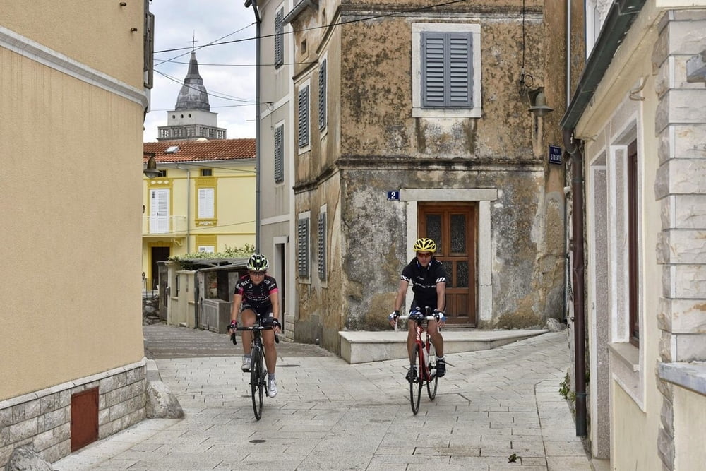
Ova staza provest će vas sa zapadne na istočnu obalu otoka te potom sve do juga i mjesta koje nosi isto ime kao i otok, Krk. Na istočnoj obali svakako posjetite gradić Vrbnik nadaleko poznat po Vrbničkoj žlahtini, jedinoj autohtonoj vinskoj sorti otoka. Grad Krk također vrijedi posjetiti i osvježiti se u nekom od mnogobrojnih krčkih kafića. Povratak je sporednim cestama prema Malinskoj i dalje prema Njivicama.

This route will take you from the west to the east coast of the island and all to the south with the town which bears the same name as the island – Krk. On the east coast be sure to visit a small town Vrbnik widely renowned for Vrbnička žlahtina, an autochthonous wine variety. The town Krk is also worth a visit and you can refresh in one of the numerous cafés. You return on minor roads to Malinska and further to Njivice. 

www.adriabike.hr
www.njiviceresort.com


Fotogalerie van de tocht

Kaart en hoogteprofiel van de tocht

  • Open Street Map
  • Google
Minimumhoogte 1 m Maximale hoogte 265 m Detailweergave

Meer over de tour auteur

AdriaBikeHotels
Lid sinds 2014

Stuur een privébericht

Commentaren

GPS-tracks

Trackpoints
  • GPX / Garmin Map Source (gpx) download
  • TCX / Garmin Training Center® (tcx) download
  • CRS / Garmin Training Center® (crs) download
  • Google Earth (kml) download
  • G7ToWin (g7t) download
  • TTQV (trk) download
  • Overlay (ovl) download
  • Fugawi (txt) download
  • Kompass (DAV) Track (tk) download
  • Pagina van de tocht (pdf) download
  • Origineel dossier van de auteur (gpx) download

Meer over de tour auteur

AdriaBikeHotels
Lid sinds 2014

Stuur een privébericht
Share track
Toevoegen aan mijn favorieten
Uit mijn favorieten verwijderen
Tags bewerken
Mijn waardering
Tarief
Tocht: ROAD NJIVICE no.4.
Type: Racefiets
Lengte: 54,9 km
Evaluated on:
Duur:
Dagen
Uurtjes
Minuten
Beoordeling: Landschap Funfactor Conditie Techniek