Inloggen

Login vergeten?

Cookies moeten worden aanvaard!
De cookiefunctie van uw browser is gedeactiveerd. Activeer de functie.

Ben je nog geen lid?

Registreer nu
Inloggen

Alleen mogelijk voor ingelogde gebruikers

Log in om deze functie te kunnen gebruiken.

Login vergeten?

Cookies moeten worden aanvaard!
De cookiefunctie van uw browser is gedeactiveerd. Activeer de functie.

Ben je nog geen lid?

Registreer nu
Filter
Categorieën
Geavanceerde filters
  • Lengte (km)
  • Hoogtemeter
Filter opslaan Filter resetten

TrackRank

QRCode

Technische gegevens

Lengte45,8 km Hoogtemeter1586 m Afdaling1581 m Duur00:00 h:m Datum08.09.2022
Beoordelingen Auteur Landschap Funfactor Conditie Techniek

Statistiek

189 Views Beoordelingen 2 Downloads Gemiddelde
Tarief
  • Pagina van de tocht
  • Route
  • Downloads

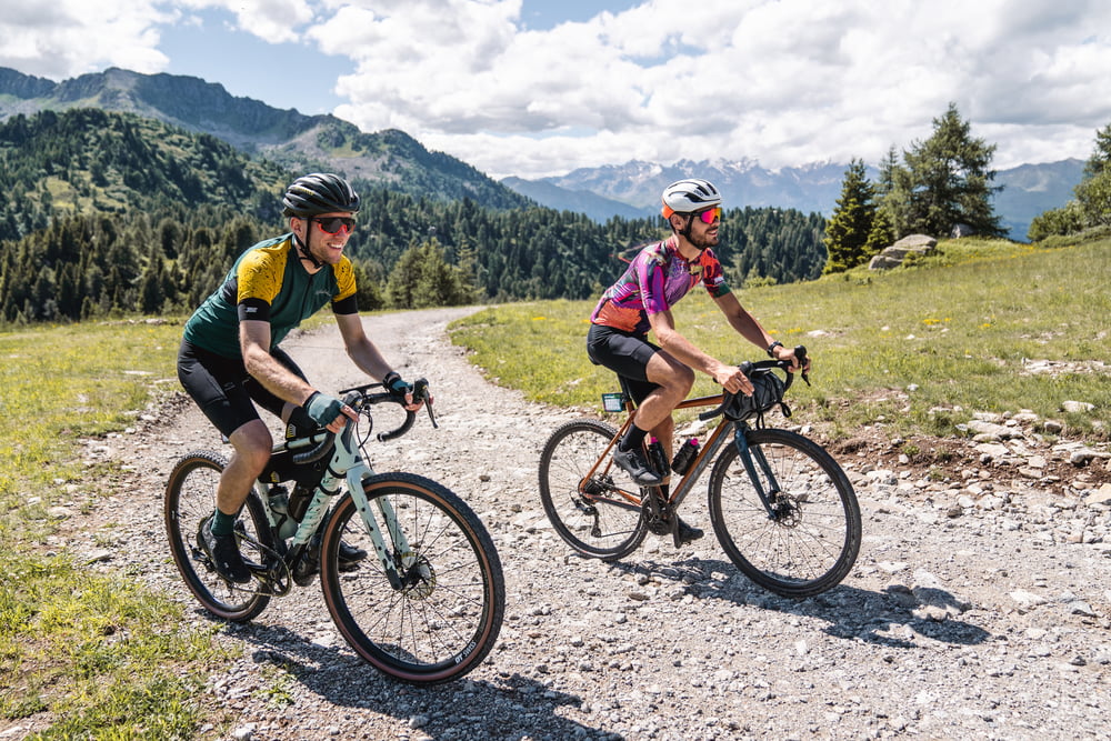
After having covered part of the "Bassa Valle" route, you take the direction of Val Meledrio. The forest begins immediately beautiful and steep but always rideable and never technical, thanks to the trees you will never suffer the heat (there is also a fountain halfway up). There are several breathtaking views of small waterfalls, streams and side valleys until you reach the large viewpoint of Madonna di Campiglio (with fountain). 

From the viewpoint onwards, the route continues uphill to the summit of Monte Vigo, where the Brenta Dolomites can be admired. There may be short stretches of portage if you lack the training for short but steep climbs. From there, you take a steep descent on a dirt road to Lago dei Caprioli. Returning to asphalt -that for the entire route you almost forget it exists- you reach Ossana and its fountain.

Verdere informatie onder

https://www.komoot.it/tour/883333695

Fotogalerie van de tocht

Kaart en hoogteprofiel van de tocht

  • Open Street Map
  • Google
Minimumhoogte 776 m Maximale hoogte 2130 m Detailweergave

Meer over de tour auteur

Helios_Bolzano
Lid sinds 2020

Stuur een privébericht

Commentaren

For directions head over https://www.visitvaldisole.it/en/how-to-get-here

GPS-tracks

Trackpoints
  • GPX / Garmin Map Source (gpx) download
  • TCX / Garmin Training Center® (tcx) download
  • CRS / Garmin Training Center® (crs) download
  • Google Earth (kml) download
  • G7ToWin (g7t) download
  • TTQV (trk) download
  • Overlay (ovl) download
  • Fugawi (txt) download
  • Kompass (DAV) Track (tk) download
  • Pagina van de tocht (pdf) download
  • Origineel dossier van de auteur (gpx) download

Meer over de tour auteur

Helios_Bolzano
Lid sinds 2020

Stuur een privébericht
Share track
Toevoegen aan mijn favorieten
Uit mijn favorieten verwijderen
Tags bewerken
Mijn waardering
Tarief
Tocht: Alpine Gravel - Monte Vigo
Type: Fietstochten
Lengte: 45,8 km
Evaluated on:
Duur:
Dagen
Uurtjes
Minuten
Beoordeling: Landschap Funfactor Conditie Techniek