Inloggen

Login vergeten?

Cookies moeten worden aanvaard!
De cookiefunctie van uw browser is gedeactiveerd. Activeer de functie.

Ben je nog geen lid?

Registreer nu
Inloggen

Alleen mogelijk voor ingelogde gebruikers

Log in om deze functie te kunnen gebruiken.

Login vergeten?

Cookies moeten worden aanvaard!
De cookiefunctie van uw browser is gedeactiveerd. Activeer de functie.

Ben je nog geen lid?

Registreer nu
Filter
Categorieën
Geavanceerde filters
  • Lengte (km)
  • Hoogtemeter
Filter opslaan Filter resetten

TrackRank

QRCode

Technische gegevens

Lengte27,9 km Hoogtemeter1469 m Afdaling1745 m Duur07:00 h:m Datum01.11.2005
Beoordelingen Auteur User Landschap Funfactor Conditie Techniek

Statistiek

5270 Views 5 Beoordelingen 584 Downloads 4.60 Gemiddelde
Tarief
  • Pagina van de tocht
  • Route
  • Downloads

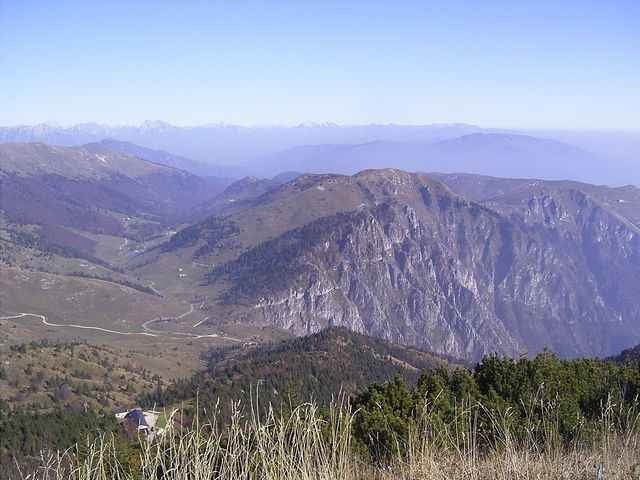
Tour on old donkey way from Bassano del Grappa - Crespano - Modonna del Cavallo to the Mt. Grappa monument (1st world war). 


 The way down is going along a trail along the mountain top with some small walking passages, than on a spectacular trail cut into the mountain with spectacular view!. The way down to San Liberale is the sentiero 153 (S1-S2 level), a good biker can drive nearly everything, but be carefull in driving, the way is most of the time small and cut into the mountain.

  If you find the sentiero 153 to difficult, in about 3km is a easy way down to  San Liberale S0
 

August 2012 - track erneurert - Auffahrt nun komplett fahrbar

Fotogalerie van de tocht

Kaart en hoogteprofiel van de tocht

  • Open Street Map
  • Google
Minimumhoogte 287 m Maximale hoogte 1734 m Detailweergave

Meer over de tour auteur

skyhopper
Lid sinds 2005

Stuur een privébericht

Commentaren

Checco on 21.12.2006

Error on the description

The sentiero of the way down in the track is not the CAI 151. I have do it, with my gps and the track of this tour does not corrisponding with my track (i have a photo of the real sentiero 151 too): http://81.208.98.134/FotoMountainBike/2006-12-17%20Grappa-cai%20151%20800x600/index.htm
I think that the sentiero in the track of this tour is the CAI 150. Next time that i going in the Monte Grappa, i'll do it.
Checco on 27.12.2006

Finally, I just do it. You have do the sentiero CAI 153 and i have found it VERY nice ! It's very spectacular. Thank you for this. I have same photo of it:
http://172.16.1.2/FotoMountainBike/2006-12-23%20Grappa%20Cai153%20800x600/index.htm
Trento on SS47 until exit Bssano, left to Romano Ezellino and Crespano. In Crespano on the traffic light left to Madonno di Cavallo church.

GPS-tracks

Trackpoints
  • GPX / Garmin Map Source (gpx) download
  • TCX / Garmin Training Center® (tcx) download
  • CRS / Garmin Training Center® (crs) download
  • Google Earth (kml) download
  • G7ToWin (g7t) download
  • TTQV (trk) download
  • Overlay (ovl) download
  • Fugawi (txt) download
  • Kompass (DAV) Track (tk) download
  • Pagina van de tocht (pdf) download
  • Origineel dossier van de auteur (gpx) download

Meer over de tour auteur

skyhopper
Lid sinds 2005

Stuur een privébericht
Share track
Toevoegen aan mijn favorieten
Uit mijn favorieten verwijderen
Tags bewerken
Mijn waardering
Tarief
Tocht: Veneto: Bassano del Grappa - Crespano - Mt Grappa 1760m sentiero 153
Type: Mountainbike
Lengte: 27,9 km
Evaluated on:
Duur:
Dagen
Uurtjes
Minuten
Beoordeling: Landschap Funfactor Conditie Techniek