
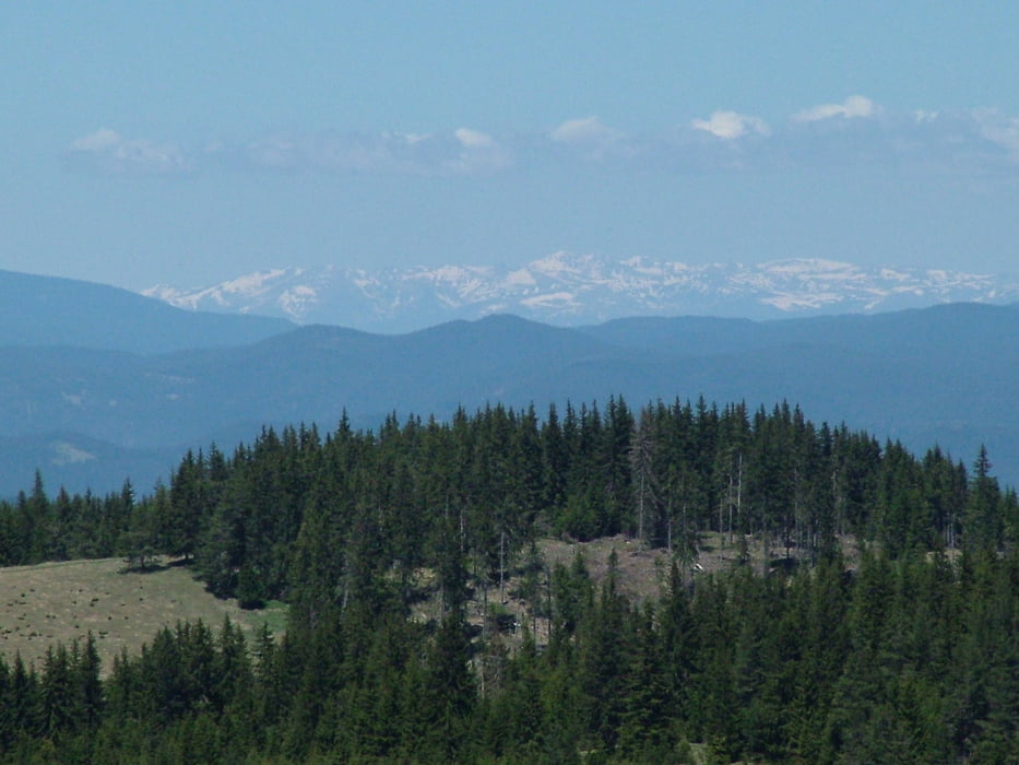

Leg seven of "Rudopia" route. The tour starts from the village of Mugla and climb up to the NW slope of Mt Shirokolashki Snezhnik - the second of height in the Rhodope Mountains - 2188 m. Great views in all directions are provided from this point. Once you reach the so called "panoramic road" the encounters endless ups and downs as it follows the 1900 contour. Eventually the forest road comes to an asphalt and crosses the main road from Devin to Smolyan in the pass called "Prevala". From "Prevala" it takes about 30 minutes on horizontal gravel road to reach the center of Pamporovo ski resort.
Verdere informatie onder
http://rudopia.org/#/bg/smolyan/Fotogalerie van de tocht


Kaart en hoogteprofiel van de tocht
Minimumhoogte 1353 m
Maximale hoogte 1796 m
Meer over de tour auteur
|
|
Pirateria |
Commentaren

GPS-tracks
Trackpoints-
GPX / Garmin Map Source (gpx) download
-
TCX / Garmin Training Center® (tcx) download
-
CRS / Garmin Training Center® (crs) download
-
Google Earth (kml) download
-
G7ToWin (g7t) download
-
TTQV (trk) download
-
Overlay (ovl) download
-
Fugawi (txt) download
-
Kompass (DAV) Track (tk) download
-
Pagina van de tocht (pdf) download
-
Origineel dossier van de auteur (gpx) download
Meer over de tour auteur
|
|
Pirateria |
Toevoegen aan mijn favorieten
Uit mijn favorieten verwijderen
Tags bewerken
Open track
Mijn waardering
Tarief