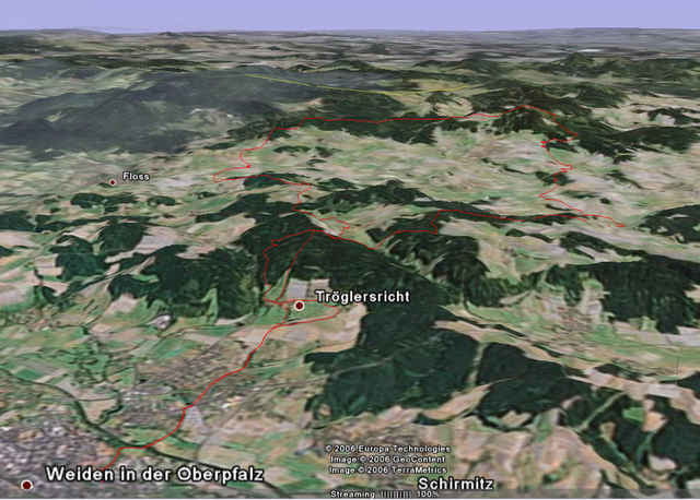
50km long MTB ride from Weiden to Oberfahrenberg and back. Mostly forrest roads with some singletrack and some gravel roads. Lots of Vertical (1180m), so plan for tired legs if you keep up a good pace.
This is one of those rides you can also do no matter how crappy the weather, since there aren't many technical sections and few roots to deal with.
--------------------------------------------------------
50km MTB Tour von Weiden nach Oberfahrenberg und zuruck. Meistens Waldwege mit Singletrack und schrotterwege auch. Auch spass wenn es Nass ist.
Kaart en hoogteprofiel van de tocht
Minimumhoogte 384 m
Maximale hoogte 808 m
Commentaren

Weiden Zentrum
GPS-tracks
Trackpoints-
GPX / Garmin Map Source (gpx) download
-
TCX / Garmin Training Center® (tcx) download
-
CRS / Garmin Training Center® (crs) download
-
Google Earth (kml) download
-
G7ToWin (g7t) download
-
TTQV (trk) download
-
Overlay (ovl) download
-
Fugawi (txt) download
-
Kompass (DAV) Track (tk) download
-
Pagina van de tocht (pdf) download
-
Origineel dossier van de auteur (gpx) download
Toevoegen aan mijn favorieten
Uit mijn favorieten verwijderen
Tags bewerken
Open track
Mijn waardering
Tarief

