


This walk follows one of the many ancient Pilgrims paths that are found in Mallorca. This 8 mile hike goes from the village of Caimari to the Lluc Monastery.
The walk is taken in the reverse from Coll de sa Bataia near to the Monastery down to the sleepy village of Caimari. This means that it is all down hill to Caimari and all uphill on the return.
The village square is a good place for a halfway rest and lunch.
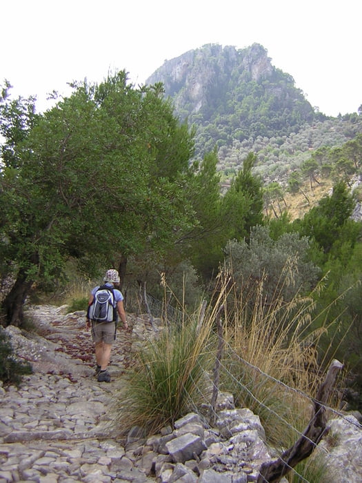
The walk crosses and recrosses the original route and occasionally uses the actual Pilgrims path that has been restored in places. The route is said to be 700 years old. There are some stupendous views along the way.
The route and path can be very rocky and uneven so good walking boots are essential.
The walk is taken in the reverse from Coll de sa Bataia near to the Monastery down to the sleepy village of Caimari. This means that it is all down hill to Caimari and all uphill on the return.
The village square is a good place for a halfway rest and lunch.
The walk crosses and recrosses the original route and occasionally uses the actual Pilgrims path that has been restored in places. The route is said to be 700 years old. There are some stupendous views along the way.
The route and path can be very rocky and uneven so good walking boots are essential.
Fotogalerie van de tocht

Kaart en hoogteprofiel van de tocht
Minimumhoogte 178 m
Maximale hoogte 613 m
Meer over de tour auteur

|
SILVAED |
Commentaren

The start of the walk is from the restaurant at the Coll de sa Bataia. You can park here and have a cold drink on your return. Or you can get a bus to the Lluc Monastery and walk from there.
GPS-tracks
Trackpoints-
GPX / Garmin Map Source (gpx) download
-
TCX / Garmin Training Center® (tcx) download
-
CRS / Garmin Training Center® (crs) download
-
Google Earth (kml) download
-
G7ToWin (g7t) download
-
TTQV (trk) download
-
Overlay (ovl) download
-
Fugawi (txt) download
-
Kompass (DAV) Track (tk) download
-
Pagina van de tocht (pdf) download
-
Origineel dossier van de auteur (gpx) download
Meer over de tour auteur
|
|
SILVAED |
Toevoegen aan mijn favorieten
Uit mijn favorieten verwijderen
Tags bewerken
Open track
Mijn waardering
Tarief