


Start und Ziel Parkplatz direkt an der Turnhalle im Schladeweg in Wallmenroth.
Schöne strecke mit an einigen Punkten besonders schöne Panoramen auf das Siegtal auf.
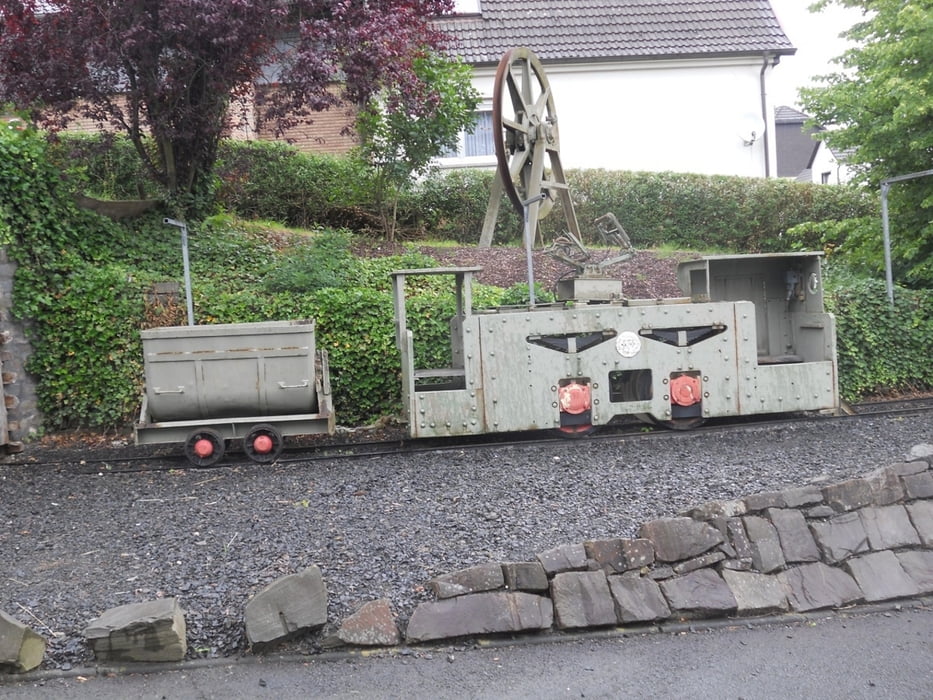
und Stolleneingang der ehemaligen Erzgrube "Vereinigung" in Katzwinkel.
Die strecke verläuft ruhig überquert aber paar mal Hauptstrasse wo man besonders aufpassen muss.
Kurz vom ende gehen wir am Bergkreuz und Mariengrotte vorbei, und noch ein paar hundert meter und wieder erreichen wir Parkplatz an der Turnhalle.
Schöne strecke mit an einigen Punkten besonders schöne Panoramen auf das Siegtal auf.
und Stolleneingang der ehemaligen Erzgrube "Vereinigung" in Katzwinkel.
Die strecke verläuft ruhig überquert aber paar mal Hauptstrasse wo man besonders aufpassen muss.
Kurz vom ende gehen wir am Bergkreuz und Mariengrotte vorbei, und noch ein paar hundert meter und wieder erreichen wir Parkplatz an der Turnhalle.
Галерея маршрутов


Карта маршрута и высотный профиль
Minimum height 196 m
Maximum height 337 m
More about the tour author
|
|
ajdda |
Комментарии

GPS-Tracks
Trackpoints-
GPX / Garmin Map Source (gpx) download
-
TCX / Garmin Training Center® (tcx) download
-
CRS / Garmin Training Center® (crs) download
-
Google Earth (kml) download
-
G7ToWin (g7t) download
-
TTQV (trk) download
-
Overlay (ovl) download
-
Fugawi (txt) download
-
Kompass (DAV) Track (tk) download
-
Формуляр маршрута (pdf) download
-
Original file of the author (gpx) download
More about the tour author
|
|
ajdda |
Add to my favorites
Remove from my favorites
Edit tags
Open track
My score
Rate