Login

Забыл пароль?

Cookies have to be accepted!
Your browser's cookie functionality is disabled. Please enable this functionality.

Not a member yet?

Register now
Login

Available for registred users only

Log in to use this feature.

Забыл пароль?

Cookies have to be accepted!
Your browser's cookie functionality is disabled. Please enable this functionality.

Not a member yet?

Register now
Filter
Категории
Advanced filters
  • Длина (км)
  • Высотомер
Сохранить фильтр Reset filter

TrackRank

QRCode

Technical data

Длина33,2 km Высотомер1315 m Way down1334 m Длительность03:00 h:m Дата14.07.2012
Оценки Author Ландшафт Веселье Кондиция Техника

Статистика

697 Виды Оценки 154 Загрузки Среднее
Rate
  • Формуляр маршрута
  • Дорога
  • Загрузки
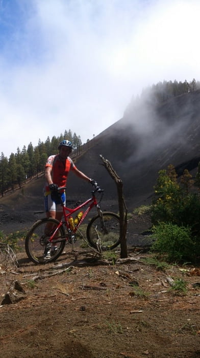
Ruta por el centro de Gran Canaria.Tafira,Bandama,Atalaya,La gavia,San Mateo,Sta Brigida.Ruta clasica.Mucho desnivel y tecnica.

Галерея маршрутов

Карта маршрута и высотный профиль

  • Open Street Map
  • Google
Minimum height 245 m Maximum height 1027 m Детальный вид

More about the tour author

madeheimclaudio
Member since 2010

Send private message

Комментарии

Salida desde Tafira .Parking en cuaquiera de sus calles.

GPS-Tracks

Trackpoints
  • GPX / Garmin Map Source (gpx) download
  • TCX / Garmin Training Center® (tcx) download
  • CRS / Garmin Training Center® (crs) download
  • Google Earth (kml) download
  • G7ToWin (g7t) download
  • TTQV (trk) download
  • Overlay (ovl) download
  • Fugawi (txt) download
  • Kompass (DAV) Track (tk) download
  • Формуляр маршрута (pdf) download
  • Original file of the author (tcx) download

More about the tour author

madeheimclaudio
Member since 2010

Send private message
Share track
Add to my favorites
Remove from my favorites
Edit tags
My score
Rate
Маршрут: Gran Canaria Centro Claudio
Вид: Горный велосипед
Длина: 33,2 km
Evaluated on:
Длительность:
Day(s)
Hour(s)
Minute(s)
Оценка: Ландшафт Веселье Кондиция Техника