
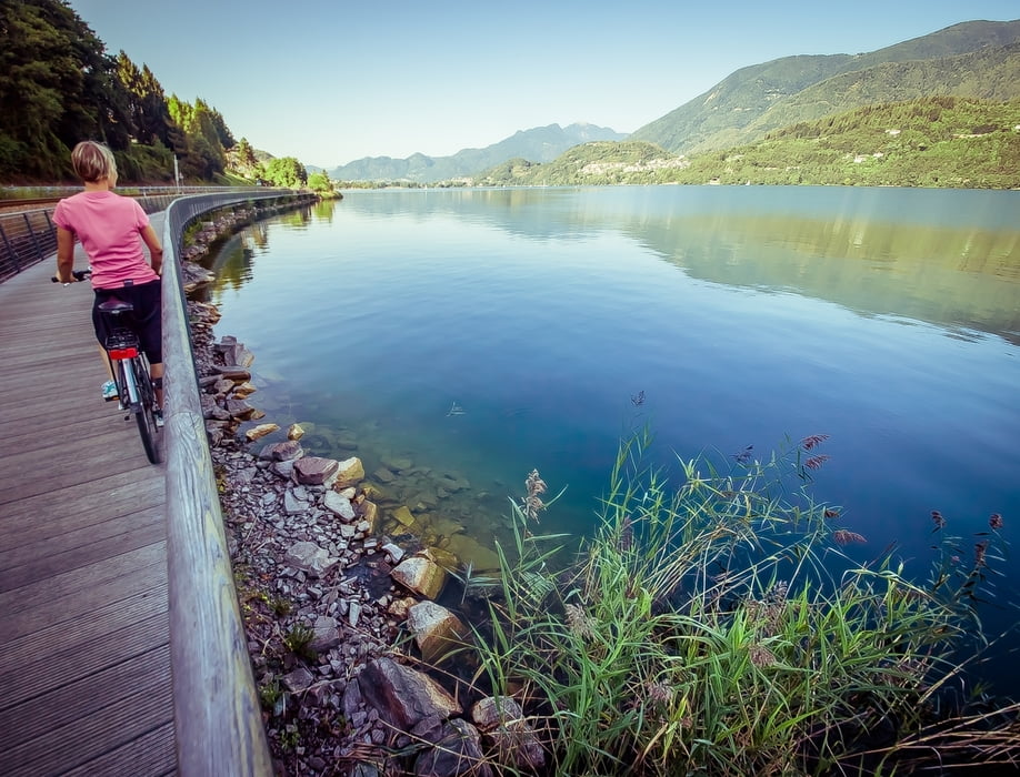

L’itinerario si sviluppa in parte su ciclabile e in parte su strade secondarie; si pedala per il primo tratto su strada asfalta che domina il lago di Levico dall’alto per i primi 3 km, si scende poi verso il lago costeggiandolo su strada sterrata per un totale di 2 km (unico tratto sterrato dell’intero tour). Si prosegue poi su un tratto in salita su strada asfaltata per giungere sotto la collina su cui si trova il Castello di Pergine fino al centro storico del paese. Si esce dall’abitato seguendo le indicazioni per Susà e dopo aver superato il sottopassaggio della SS47 si segue una stradina asfaltata che porta a Canale per poi continuare sulla ciclabile lungo il lago di Caldonazzo per ritornare, passando tra i meleti, al punto di partenza.
TOUR UM DIE SEEN
Die Strecke verläuft teilweise auf dem Radweg und teilweise auf Nebenstraßen; auf dem ersten Abschnitt radelt man 3km auf asphaltierter Straße, direkt über dem Levico see, danach geht es bergab zum See und 2km an dessen Ufer entlang (das ist der einzige Streckenabschnitt der Tour auf nicht asphaltierter Straße). Es geht dann bergauf, auf einem asphaltierten Streckenabschnitt, bis man den Hügel erreicht, auf dem das Schloss Pergine steht. Man fährt weiter bis ins Zentrum des Ortes. Danach verlässt man Pergine in Richtung Susà (ausgeschildert) und nach der Unterführung der Staatsstraße SS47 folgt man einer asphaltierten Straße in Richtung Canale, um dann auf dem Radweg weiterzufahren, der am Ufer des Caldonazzosees entlang führt. So gelangt man zwischen Apfelplantagen zurück zum Ausgangspunkt.
THE TOURS OF THE LAKES
The trail takes you on the cycling path and on secondary roads; the first part is on an asphalt road that overlooks Levico Lake for 3 km; ride down and bike on the dirt road along the lake for 2 km (this is the only unpaved road of the tour). The route continues on a part of ascending asphalt road, passing beneath “Castello di Pergine” hill until you reach the historic center of the town. Leave the village and follow signs for Susà; after the SS47 underpass, follow the asphalt road that leads to Canale and continue on the cycling path along Caldonazzo Lake to return to the starting point passing through the apple orchards.
Карта маршрута и высотный профиль
Minimum height 430 m
Maximum height 562 m
More about the tour author

|
valsuganaapt |
Комментарии

GPS-Tracks
Trackpoints-
GPX / Garmin Map Source (gpx) download
-
TCX / Garmin Training Center® (tcx) download
-
CRS / Garmin Training Center® (crs) download
-
Google Earth (kml) download
-
G7ToWin (g7t) download
-
TTQV (trk) download
-
Overlay (ovl) download
-
Fugawi (txt) download
-
Kompass (DAV) Track (tk) download
-
Формуляр маршрута (pdf) download
-
Original file of the author (gpx) download
More about the tour author
|
|
valsuganaapt |
Add to my favorites
Remove from my favorites
Edit tags
Open track
My score
Rate