


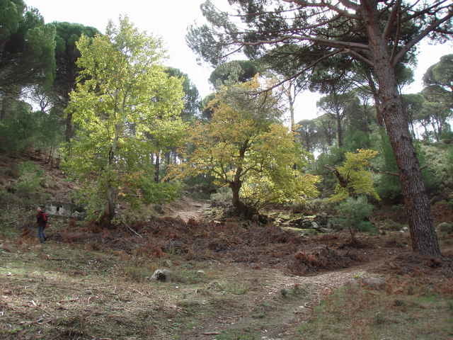
This is a pleasant and versatile hike through the Kozak Mountains located between Ayvalik and Pergamon (Bergama). Starting point is at a spring (monument) located close to a riverbed. The walk is easily accessed by car (paved road, but look out for the pot-holes near the trail head). The hike first follows the riverbed and then goes straight up a small mountain. The short climb is rewarded with impressive views of the pine tree forests covering the Kozak Mountains. The hike continues along the mountain rim and passes through some olive groves. Just after hitting another small mountain road it turns into the valley again. The remaining part of the walk is through forest and along a small river and gives ample opportunity for breaks and (in spring and early summer) refreshment. The hike can be rounded-off with some "Boerek" and "Chay" in the near-by Kozak Cafe in "Demircidere" while enjoying the views over vineyards and mountains.
Галерея маршрутов
Карта маршрута и высотный профиль
Minimum height 120 m
Maximum height 409 m
More about the tour author

|
fgoettsche |
Комментарии

From Ayvalik, take the mountain road via "Yeniköy" in direction Kozak and turn off just before the little village of Demircidere. Alternatively, you can take the same road but in opposite direction from Bergama.
GPS-Tracks
Trackpoints-
GPX / Garmin Map Source (gpx) download
-
TCX / Garmin Training Center® (tcx) download
-
CRS / Garmin Training Center® (crs) download
-
Google Earth (kml) download
-
G7ToWin (g7t) download
-
TTQV (trk) download
-
Overlay (ovl) download
-
Fugawi (txt) download
-
Kompass (DAV) Track (tk) download
-
Формуляр маршрута (pdf) download
-
Original file of the author (g7t) download
More about the tour author
|
|
fgoettsche |
Add to my favorites
Remove from my favorites
Edit tags
Open track
My score
Rate