Login

Забыл пароль?

Cookies have to be accepted!
Your browser's cookie functionality is disabled. Please enable this functionality.

Not a member yet?

Register now
Login

Available for registred users only

Log in to use this feature.

Забыл пароль?

Cookies have to be accepted!
Your browser's cookie functionality is disabled. Please enable this functionality.

Not a member yet?

Register now
Filter
Категории
Advanced filters
  • Длина (км)
  • Высотомер
Сохранить фильтр Reset filter

TrackRank

QRCode

Technical data

Длина29,4 km Высотомер1014 m Way down702 m Длительность00:00 h:m Дата25.11.2007
Оценки Author Ландшафт Веселье Кондиция Техника

Статистика

2013 Виды Оценки 439 Загрузки Среднее
Rate
  • Формуляр маршрута
  • Дорога
  • Загрузки
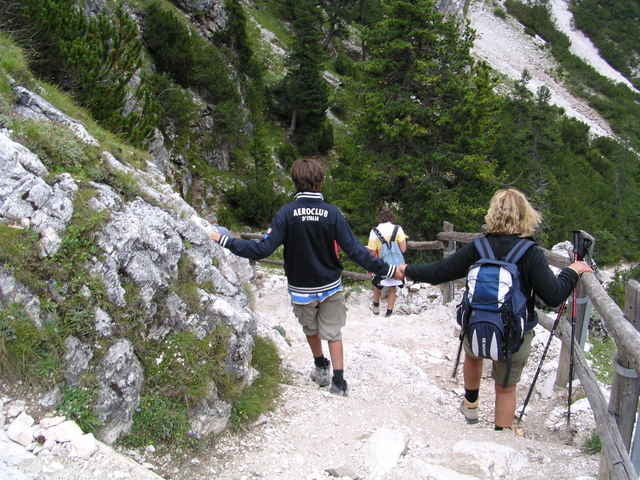
Auf breiten Schotterwege durch Wunderschöne Landschaften.
Die Tour beginnt Kurz nach St-Vigl und führt über
Rif Pederu - Faneshütte nach St- Kassian.

Галерея маршрутов

Карта маршрута и высотный профиль

  • Open Street Map
  • Google
Minimum height 1234 m Maximum height 2165 m Детальный вид

More about the tour author

julianernst
Member since 2007

Send private message

Комментарии

GPS-Tracks

Trackpoints
  • GPX / Garmin Map Source (gpx) download
  • TCX / Garmin Training Center® (tcx) download
  • CRS / Garmin Training Center® (crs) download
  • Google Earth (kml) download
  • G7ToWin (g7t) download
  • TTQV (trk) download
  • Overlay (ovl) download
  • Fugawi (txt) download
  • Kompass (DAV) Track (tk) download
  • Формуляр маршрута (pdf) download
  • Original file of the author (gpx) download

More about the tour author

julianernst
Member since 2007

Send private message
Share track
Add to my favorites
Remove from my favorites
Edit tags
My score
Rate
Маршрут: Naturpark Fanes
Вид: Горный велосипед
Длина: 29,4 km
Evaluated on:
Длительность:
Day(s)
Hour(s)
Minute(s)
Оценка: Ландшафт Веселье Кондиция Техника