Login

Забыл пароль?

Cookies have to be accepted!
Your browser's cookie functionality is disabled. Please enable this functionality.

Not a member yet?

Register now
Login

Available for registred users only

Log in to use this feature.

Забыл пароль?

Cookies have to be accepted!
Your browser's cookie functionality is disabled. Please enable this functionality.

Not a member yet?

Register now
Filter
Категории
Advanced filters
  • Длина (км)
  • Высотомер
Сохранить фильтр Reset filter

TrackRank

QRCode

Technical data

Длина8,3 km Высотомер351 m Way down349 m Длительность03:00 h:m Дата03.11.2013
Оценки Author Ландшафт Веселье Кондиция Техника

Статистика

426 Виды Оценки 43 Загрузки Среднее
Rate
  • Формуляр маршрута
  • Дорога
  • Загрузки

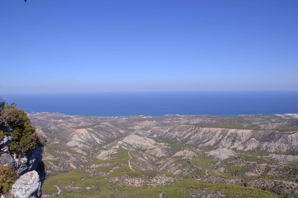
Sehr schöne Wanderung im Fünfingergebirge.

Die Wanderung beginnt am Wanderparkplat 5,3 Kilometer nachdem man von der Passhöhe Buffavento in Richtung Alevkaya fährt am wunderschönen Panaromaausblick. 


Галерея маршрутов

Карта маршрута и высотный профиль

  • Open Street Map
  • Google
Minimum height 472 m Maximum height 765 m Детальный вид

More about the tour author

msdetroit
Member since 2007

Send private message

Комментарии

GPS-Tracks

Trackpoints
  • GPX / Garmin Map Source (gpx) download
  • TCX / Garmin Training Center® (tcx) download
  • CRS / Garmin Training Center® (crs) download
  • Google Earth (kml) download
  • G7ToWin (g7t) download
  • TTQV (trk) download
  • Overlay (ovl) download
  • Fugawi (txt) download
  • Kompass (DAV) Track (tk) download
  • Формуляр маршрута (pdf) download
  • Original file of the author (gpx) download

More about the tour author

msdetroit
Member since 2007

Send private message
Share track
Add to my favorites
Remove from my favorites
Edit tags
My score
Rate
Маршрут: Klosterruine Viran Kilise
Вид: Пешеходный туризм
Длина: 8,3 km
Evaluated on:
Длительность:
Day(s)
Hour(s)
Minute(s)
Оценка: Ландшафт Веселье Кондиция Техника