Login

Забыл пароль?

Cookies have to be accepted!
Your browser's cookie functionality is disabled. Please enable this functionality.

Not a member yet?

Register now
Login

Available for registred users only

Log in to use this feature.

Забыл пароль?

Cookies have to be accepted!
Your browser's cookie functionality is disabled. Please enable this functionality.

Not a member yet?

Register now
Filter
Категории
Advanced filters
  • Длина (км)
  • Высотомер
Сохранить фильтр Reset filter

TrackRank

QRCode

Technical data

Длина4,5 km Высотомер100 m Way down93 m Длительность00:00 h:m Дата18.11.2013
Оценки Author Ландшафт Веселье Кондиция Техника

Статистика

1361 Виды Оценки 28 Загрузки Среднее
Rate
  • Формуляр маршрута
  • Дорога
  • Загрузки


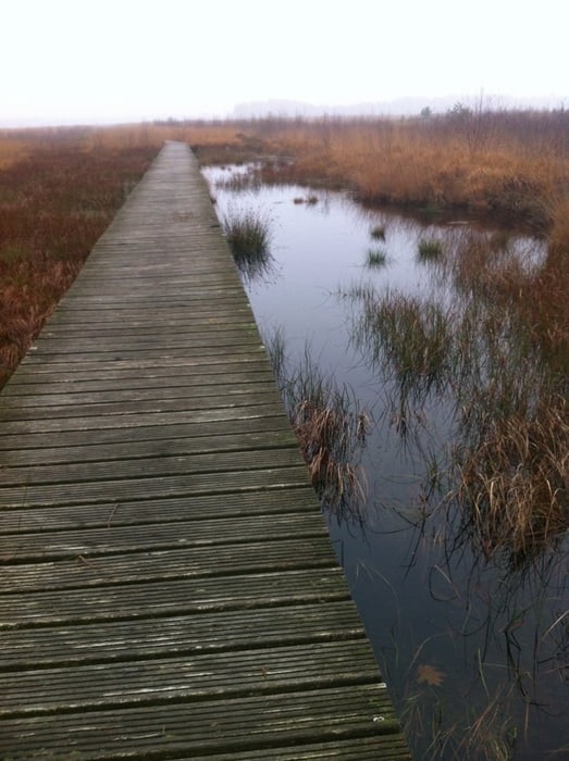
Een wandeling door het Haaksbergerveen op een nevelige ochtend over stille bospaden, over de houten vlonders in het veengebied, hier verstilt de natuur in een decor van rimpelloos water en een witte lucht.

Галерея маршрутов

Карта маршрута и высотный профиль

  • Open Street Map
  • Google
Minimum height Maximum height 56 m Детальный вид

More about the tour author

eddavids
Member since 2012

Send private message

Комментарии

GPS-Tracks

Trackpoints
  • GPX / Garmin Map Source (gpx) download
  • TCX / Garmin Training Center® (tcx) download
  • CRS / Garmin Training Center® (crs) download
  • Google Earth (kml) download
  • G7ToWin (g7t) download
  • TTQV (trk) download
  • Overlay (ovl) download
  • Fugawi (txt) download
  • Kompass (DAV) Track (tk) download
  • Формуляр маршрута (pdf) download
  • Original file of the author (gpx) download

More about the tour author

eddavids
Member since 2012

Send private message
Share track
Add to my favorites
Remove from my favorites
Edit tags
My score
Rate
Маршрут: Haaksbergerveen
Вид: Пешеходный туризм
Длина: 4,5 km
Evaluated on:
Длительность:
Day(s)
Hour(s)
Minute(s)
Оценка: Ландшафт Веселье Кондиция Техника