Login

Забыл пароль?

Cookies have to be accepted!
Your browser's cookie functionality is disabled. Please enable this functionality.

Not a member yet?

Register now
Login

Available for registred users only

Log in to use this feature.

Забыл пароль?

Cookies have to be accepted!
Your browser's cookie functionality is disabled. Please enable this functionality.

Not a member yet?

Register now
Filter
Категории
Advanced filters
  • Длина (км)
  • Высотомер
Сохранить фильтр Reset filter

TrackRank

QRCode

Technical data

Длина35,8 km Высотомер744 m Way down739 m Длительность00:00 h:m Дата13.01.2014
Оценки Author Ландшафт Веселье Кондиция Техника

Статистика

631 Виды Оценки 75 Загрузки Среднее
Rate
  • Формуляр маршрута
  • Дорога
  • Загрузки

Supergave tocht voor de mtb :)

Mooie technische afdalingen en pittige beklimmingen veelal naast de hoofdweg Hermannsweg.


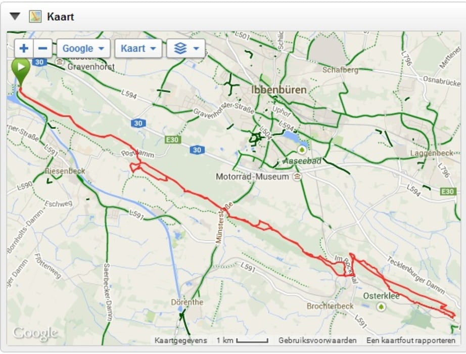
Карта маршрута и высотный профиль

  • Open Street Map
  • Google
Minimum height 66 m Maximum height 189 m Детальный вид

More about the tour author

KevinHengelo
Member since 2013

Send private message

Комментарии

starten vanaf Hörstel, afrit 10 op de snelweg vanaf De Lutte richting Osnabrück

GPS-Tracks

Trackpoints
  • GPX / Garmin Map Source (gpx) download
  • TCX / Garmin Training Center® (tcx) download
  • CRS / Garmin Training Center® (crs) download
  • Google Earth (kml) download
  • G7ToWin (g7t) download
  • TTQV (trk) download
  • Overlay (ovl) download
  • Fugawi (txt) download
  • Kompass (DAV) Track (tk) download
  • Формуляр маршрута (pdf) download
  • Original file of the author (gpx) download

More about the tour author

KevinHengelo
Member since 2013

Send private message
Share track
Add to my favorites
Remove from my favorites
Edit tags
My score
Rate
Маршрут: H-weg Hörstel/Tecklenburg/Hörstel
Вид: Горный велосипед
Длина: 35,8 km
Evaluated on:
Длительность:
Day(s)
Hour(s)
Minute(s)
Оценка: Ландшафт Веселье Кондиция Техника