


Start: Refugio del Pilar bei EL Paso
Ende: Los Canarios Haltestelle
Rückfahrt per Fahrgemeinschaft oder Taxi
Traum-Tour die am Anfang von 1440m auf 1935m (Deserda 2)ansteigt und dann beständig bis 722m hinunter führt.
Nach dem Anstieg hat man die Insel praktisch vor sich liegen - fantastisch.
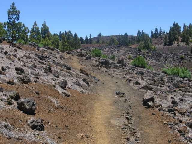
Sehr gut beschildert
Foraussetzung ist, das der Grat frei von Wolken und der Wind nicht zu heftig ist. Genug Getränke mitnehmen.
Ende: Los Canarios Haltestelle
Rückfahrt per Fahrgemeinschaft oder Taxi
Traum-Tour die am Anfang von 1440m auf 1935m (Deserda 2)ansteigt und dann beständig bis 722m hinunter führt.
Nach dem Anstieg hat man die Insel praktisch vor sich liegen - fantastisch.
Sehr gut beschildert
Foraussetzung ist, das der Grat frei von Wolken und der Wind nicht zu heftig ist. Genug Getränke mitnehmen.
Галерея маршрутов
Карта маршрута и высотный профиль
Minimum height 710 m
Maximum height 1934 m
More about the tour author

|
martin999 |
Комментарии

Von EL Paso > Santa Cruz vor Tunnel rechts > Refugio del Pilar
GPS-Tracks
Trackpoints-
GPX / Garmin Map Source (gpx) download
-
TCX / Garmin Training Center® (tcx) download
-
CRS / Garmin Training Center® (crs) download
-
Google Earth (kml) download
-
G7ToWin (g7t) download
-
TTQV (trk) download
-
Overlay (ovl) download
-
Fugawi (txt) download
-
Kompass (DAV) Track (tk) download
-
Формуляр маршрута (pdf) download
-
Original file of the author (gpx) download
More about the tour author
|
|
martin999 |
Add to my favorites
Remove from my favorites
Edit tags
Open track
My score
Rate