Login

Забыл пароль?

Cookies have to be accepted!
Your browser's cookie functionality is disabled. Please enable this functionality.

Not a member yet?

Register now
Login

Available for registred users only

Log in to use this feature.

Забыл пароль?

Cookies have to be accepted!
Your browser's cookie functionality is disabled. Please enable this functionality.

Not a member yet?

Register now
Filter
Категории
Advanced filters
  • Длина (км)
  • Высотомер
Сохранить фильтр Reset filter

TrackRank

QRCode

Technical data

Длина8,5 km Высотомер98 m Way down34 m Длительность06:00 h:m Дата16.07.2014
Оценки Author Ландшафт Веселье Кондиция Техника

Статистика

603 Виды Оценки 28 Загрузки Среднее
Rate
  • Формуляр маршрута
  • Дорога
  • Загрузки

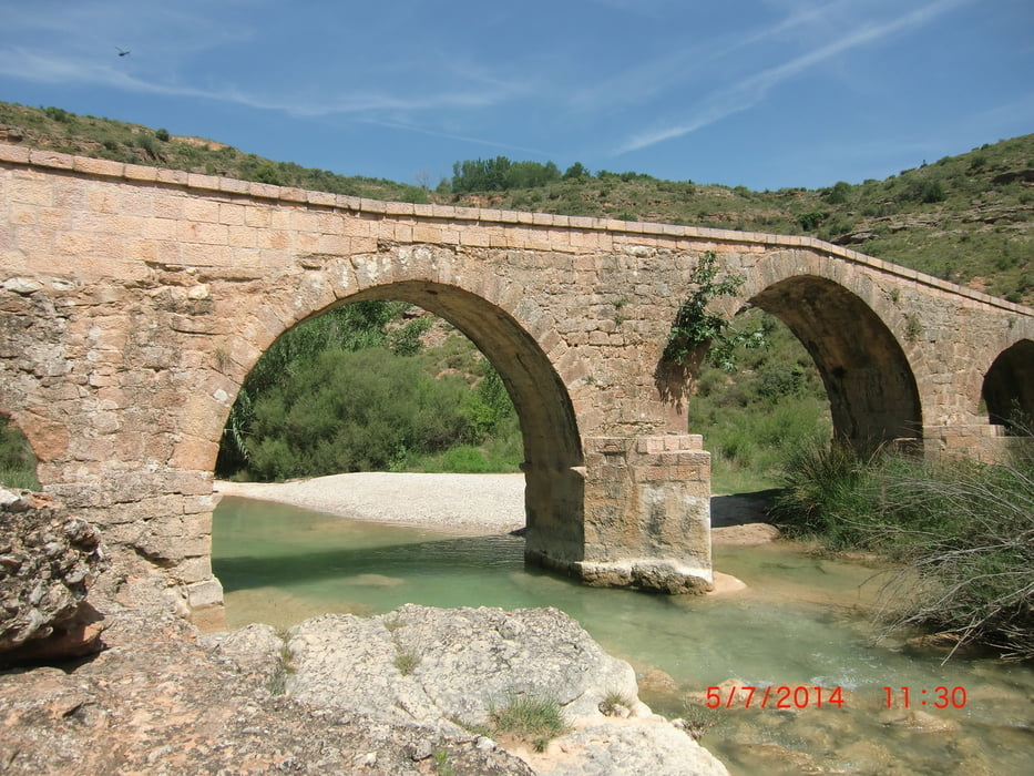
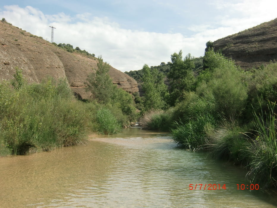
Wanderung vom Campingplatz "Rio Vero" am und im Rio Vero entlang. Hin und zurück. Wunderschöne Schlucht! Wasserfeste Turnschuhe empfehlenswert.


Галерея маршрутов

Карта маршрута и высотный профиль

  • Open Street Map
  • Google
Minimum height 417 m Maximum height 505 m Детальный вид

More about the tour author

seestadl
Member since 2013

Send private message

Комментарии

Der Campingplatz Rio Vero befindet sich kurz vor Alquezar ein paar hundert Meter auf der Straße Richting Colungo.


GPS-Tracks

Trackpoints
  • GPX / Garmin Map Source (gpx) download
  • TCX / Garmin Training Center® (tcx) download
  • CRS / Garmin Training Center® (crs) download
  • Google Earth (kml) download
  • G7ToWin (g7t) download
  • TTQV (trk) download
  • Overlay (ovl) download
  • Fugawi (txt) download
  • Kompass (DAV) Track (tk) download
  • Формуляр маршрута (pdf) download
  • Original file of the author (gpx) download

More about the tour author

seestadl
Member since 2013

Send private message
Share track
Add to my favorites
Remove from my favorites
Edit tags
My score
Rate
Маршрут: Sierra Guara Nationalpark: Am Rio Vero entlang
Вид: Пешеходный туризм
Длина: 8,5 km
Evaluated on:
Длительность:
Day(s)
Hour(s)
Minute(s)
Оценка: Ландшафт Веселье Кондиция Техника