Login

Забыл пароль?

Cookies have to be accepted!
Your browser's cookie functionality is disabled. Please enable this functionality.

Not a member yet?

Register now
Login

Available for registred users only

Log in to use this feature.

Забыл пароль?

Cookies have to be accepted!
Your browser's cookie functionality is disabled. Please enable this functionality.

Not a member yet?

Register now
Filter
Категории
Advanced filters
  • Длина (км)
  • Высотомер
Сохранить фильтр Reset filter

TrackRank

QRCode

Technical data

Длина6,1 km Высотомер631 m Way down792 m Длительность00:00 h:m Дата22.09.2014
Оценки Author Ландшафт Веселье Кондиция Техника

Статистика

835 Виды Оценки 109 Загрузки Среднее
Rate
  • Формуляр маршрута
  • Дорога
  • Загрузки
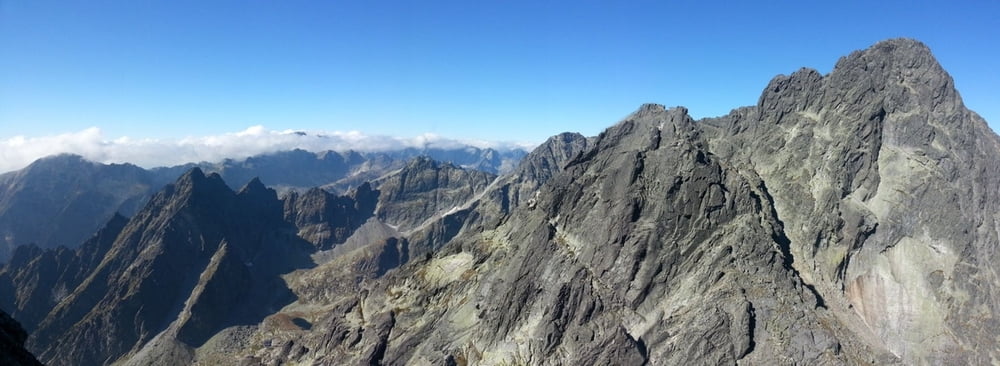
Téryho chata, Bachledová štrbina, Jordánová štrbina, Sedielko pod Lomnickým, Lomnický štít, Lomnické sedlo, Skalnaté pleso

Галерея маршрутов

Карта маршрута и высотный профиль

  • Open Street Map
  • Google
Minimum height 1763 m Maximum height 2593 m Детальный вид

More about the tour author

PeterNemeth
Member since 2011

Send private message

Комментарии

S.    Smokovec, Hrebienok

GPS-Tracks

Trackpoints
  • GPX / Garmin Map Source (gpx) download
  • TCX / Garmin Training Center® (tcx) download
  • CRS / Garmin Training Center® (crs) download
  • Google Earth (kml) download
  • G7ToWin (g7t) download
  • TTQV (trk) download
  • Overlay (ovl) download
  • Fugawi (txt) download
  • Kompass (DAV) Track (tk) download
  • Формуляр маршрута (pdf) download
  • Original file of the author (gpx) download

More about the tour author

PeterNemeth
Member since 2011

Send private message
Share track
Add to my favorites
Remove from my favorites
Edit tags
My score
Rate
Маршрут: Lomnický štít
Вид: Горный маршрут
Длина: 6,1 km
Evaluated on:
Длительность:
Day(s)
Hour(s)
Minute(s)
Оценка: Ландшафт Веселье Кондиция Техника