Login

Забыл пароль?

Cookies have to be accepted!
Your browser's cookie functionality is disabled. Please enable this functionality.

Not a member yet?

Register now
Login

Available for registred users only

Log in to use this feature.

Забыл пароль?

Cookies have to be accepted!
Your browser's cookie functionality is disabled. Please enable this functionality.

Not a member yet?

Register now
Filter
Категории
Advanced filters
  • Длина (км)
  • Высотомер
Сохранить фильтр Reset filter

TrackRank

QRCode

Technical data

Длина1.732,1 km Высотомер11251 m Way down11297 m Длительность00:00 h:m Дата27.03.2008
Оценки Author Ландшафт Веселье Кондиция Техника

Статистика

713 Виды 1 Оценка 175 Загрузки 5.00 Среднее
Rate
  • Формуляр маршрута
  • Дорога
  • Загрузки
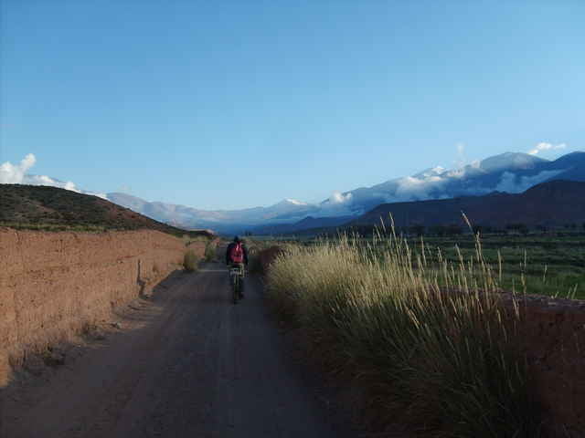
tour auf der legendären ruta 40, parallel zum andenhauptkamm, im ersten teil überwiegend auf asphalt, im zweiten auf schotter. überquerung des abra del acay, mit 4970 m der höchste pass argentiniens. Anspruchsvolle tour durch eine faszinierende landschaft. Ausreichend versorgungs- und unterkunftsmöglichkeiten.

Карта маршрута и высотный профиль

  • Open Street Map
  • Google
Minimum height 913 m Maximum height 4993 m Детальный вид

More about the tour author

hermann

Комментарии

GPS-Tracks

Trackpoints
  • GPX / Garmin Map Source (gpx) download
  • TCX / Garmin Training Center® (tcx) download
  • CRS / Garmin Training Center® (crs) download
  • Google Earth (kml) download
  • G7ToWin (g7t) download
  • TTQV (trk) download
  • Overlay (ovl) download
  • Fugawi (txt) download
  • Kompass (DAV) Track (tk) download
  • Формуляр маршрута (pdf) download
  • Original file of the author (gpx) download

More about the tour author

hermann

Share track
Add to my favorites
Remove from my favorites
Edit tags
My score
Rate
Маршрут: ruta 40 von jachal nach san antonio de los cobres
Вид: Горный велосипед
Длина: 1.732,1 km
Evaluated on:
Длительность:
Day(s)
Hour(s)
Minute(s)
Оценка: Ландшафт Веселье Кондиция Техника