

Die Tour beginnt im Stadtteil Flingern. In der Innenstadt ist der Verlauf der Düssel kaum auszumachen und führt teilweise unterirdisch.
Der Track führt immer möglichst nahe an der Düssel entlang, ist deshalb länger als die direkte Tour zur Quelle (siehe Tour #140963) und zum Teil über nicht asphaltierte schmale Pfade. Man braucht aber kein Mountainbike.
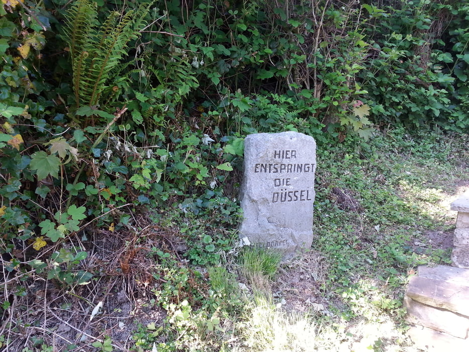
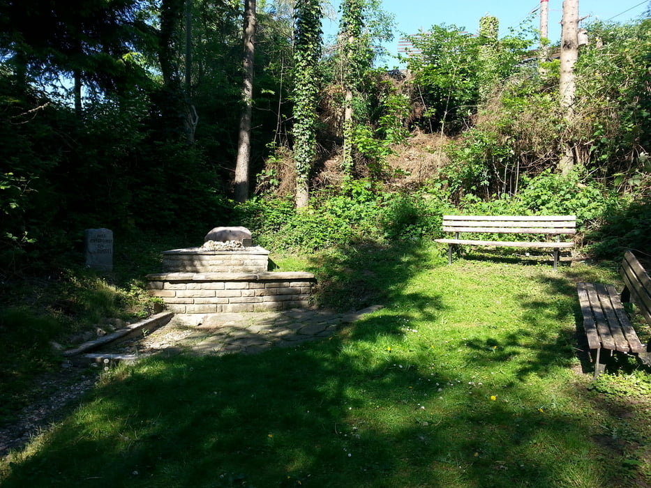
Die Quelle selbst liegt neben einem Gehöft, ist sehr unspektakulär und führt im Sommer selten Wasser. Der Weg ist hier das Ziel und ein echtes Highlight.
Ewas Kondition muss man wegen der vielen kleinen Steigungen und wegen der nicht asphaltierten Stücke mitbringen.
Галерея маршрутов
Карта маршрута и высотный профиль
Minimum height 39 m
Maximum height 278 m
More about the tour author

|
Zohren |
Комментарии

GPS-Tracks
Trackpoints-
GPX / Garmin Map Source (gpx) download
-
TCX / Garmin Training Center® (tcx) download
-
CRS / Garmin Training Center® (crs) download
-
Google Earth (kml) download
-
G7ToWin (g7t) download
-
TTQV (trk) download
-
Overlay (ovl) download
-
Fugawi (txt) download
-
Kompass (DAV) Track (tk) download
-
Формуляр маршрута (pdf) download
-
Original file of the author (gpx) download
More about the tour author
|
|
Zohren |
Add to my favorites
Remove from my favorites
Edit tags
Open track
My score
Rate