
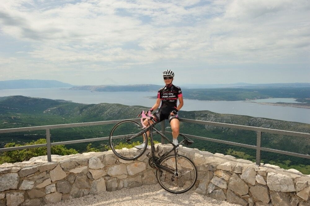

Jedna malo zahtjevnija ruta s obzirom na visinski profil i penjanje od skoro 1.300 metara no ruta koju svakako vrijedi doživjeti. Kreće iz Njivica i prelaskom Krčkog mosta kreće u unutrašnjost i zaleđe Crikvenice te se penje na skoro 800 metara nadmorske visine i vodi kroz seriju vidikovaca nazvanih "Oči vinodola". Povratak je uz Tribaljsko jezero i preko Krčkog mosta ponovno nazad u Njivice.
A somewhat more demanding route considering the height altitude and ascent to almost 1 300 meters, but one you should definitely experience. It starts from Njivice and passes over the Krk Bridge (Krčki most) into the inland and hinterland of Crikvenica and ascends to almost 800 meters above the sea level. It leads through a series of belvederes named "The Eyes of Vinodol". You return next to Tribalj Lake and over the Krk Bridge back to Njivice.
www.adriabike.hr
www.njiviceresort.com
Галерея маршрутов


Карта маршрута и высотный профиль
Minimum height 8 m
Maximum height 777 m
More about the tour author
|
|
AdriaBikeHotels |
Комментарии

GPS-Tracks
Trackpoints-
GPX / Garmin Map Source (gpx) download
-
TCX / Garmin Training Center® (tcx) download
-
CRS / Garmin Training Center® (crs) download
-
Google Earth (kml) download
-
G7ToWin (g7t) download
-
TTQV (trk) download
-
Overlay (ovl) download
-
Fugawi (txt) download
-
Kompass (DAV) Track (tk) download
-
Формуляр маршрута (pdf) download
-
Original file of the author (gpx) download
More about the tour author
|
|
AdriaBikeHotels |
Add to my favorites
Remove from my favorites
Edit tags
Open track
My score
Rate