

The remarkable experience of the Park is even more exciting if one takes a closer look at its forest ecological systems, prevailing on over three-quarters of its surface. These instructive trails tell stories about the forest systems native to the Plitvice lakes area that harbour biodiversity helping the lake ecosystems proliferate. The trails lead through large forest complexes and mountain meadows with wonderful viewpoints. Boards accompany the itinerary, leading the reader through enchanting forest wildlife habitats and historical and cultural sights of this area. The trails are quite long and the terrain varies, so explorers will also benefit from its recreational aspects.
The forests and meadows are home to various wildlife species such as bear, wolf, roe deer, red deer, lynx and wildcat. Therefore, if you are lucky enough, you may encounter some of these on the way! If this does not happen, though, the tracks they leave are also interesting (prints, excrement etc.) Birdsong (woodpeckers and singing birds) in harmony with the creaking of centennial tree branches swaying in the wind create an unforgettable symphony of nature.
Галерея маршрутов


Карта маршрута и высотный профиль
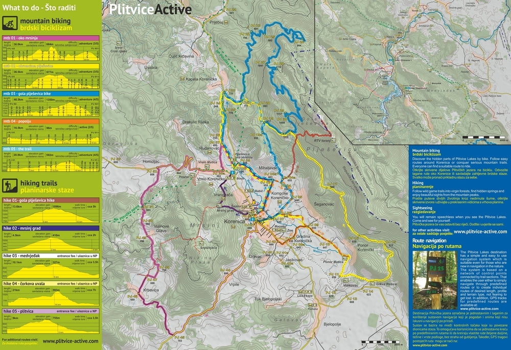
Minimum height 523 m
Maximum height 1084 m
More about the tour author
|
|
PlitviceActive |
Комментарии

The beginning of this trail is at Labudovac (panoramic train stop no. 4), over point 1, forking off from the trail called Plitvica, to Corkova Uvala Village (2) and back over Mt Preka Kosa to point no. 3, where it joins Plitvica trail again and leads further on to the ship dock (P3) at Kozjacka draga.
GPS-Tracks
Trackpoints-
GPX / Garmin Map Source (gpx) download
-
TCX / Garmin Training Center® (tcx) download
-
CRS / Garmin Training Center® (crs) download
-
Google Earth (kml) download
-
G7ToWin (g7t) download
-
TTQV (trk) download
-
Overlay (ovl) download
-
Fugawi (txt) download
-
Kompass (DAV) Track (tk) download
-
Формуляр маршрута (pdf) download
-
Original file of the author (gpx) download
More about the tour author
|
|
PlitviceActive |
Add to my favorites
Remove from my favorites
Edit tags
Open track
My score
Rate