Login

Забыл пароль?

Cookies have to be accepted!
Your browser's cookie functionality is disabled. Please enable this functionality.

Not a member yet?

Register now
Login

Available for registred users only

Log in to use this feature.

Забыл пароль?

Cookies have to be accepted!
Your browser's cookie functionality is disabled. Please enable this functionality.

Not a member yet?

Register now
Filter
Категории
Advanced filters
  • Длина (км)
  • Высотомер
Сохранить фильтр Reset filter

TrackRank

QRCode

Technical data

Длина12,1 km Высотомер177 m Way down178 m Длительность02:09 h:m Дата02.06.2016
Оценки Author Ландшафт Веселье Кондиция Техника

Статистика

245 Виды Оценки 7 Загрузки Среднее
Rate
  • Формуляр маршрута
  • Дорога
  • Загрузки
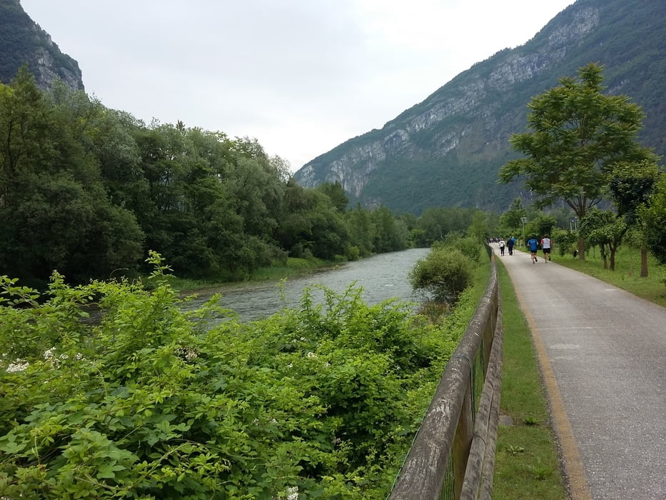
Bella marcia, abbastanza facile che si è svolta quasi esclusivamente immersi nella lussureggiante vegetazione del fiume Brenta con il corso dell'acqua quasi sempre in vista.

Further information at

http://www.visitvalsugana.it/it/

Карта маршрута и высотный профиль

  • Open Street Map
  • Google
Minimum height 213 m Maximum height 294 m Детальный вид

More about the tour author

agosflavio
Member since 2013

Send private message

Комментарии

GPS-Tracks

Trackpoints
  • GPX / Garmin Map Source (gpx) download
  • TCX / Garmin Training Center® (tcx) download
  • CRS / Garmin Training Center® (crs) download
  • Google Earth (kml) download
  • G7ToWin (g7t) download
  • TTQV (trk) download
  • Overlay (ovl) download
  • Fugawi (txt) download
  • Kompass (DAV) Track (tk) download
  • Формуляр маршрута (pdf) download
  • Original file of the author (gpx) download

More about the tour author

agosflavio
Member since 2013

Send private message
Share track
Add to my favorites
Remove from my favorites
Edit tags
My score
Rate
Маршрут: Su e do par el Masaron a Pianello di Enego (VI)
Вид: Горный маршрут
Длина: 12,1 km
Evaluated on:
Длительность:
Day(s)
Hour(s)
Minute(s)
Оценка: Ландшафт Веселье Кондиция Техника