Login

Забыл пароль?

Cookies have to be accepted!
Your browser's cookie functionality is disabled. Please enable this functionality.

Not a member yet?

Register now
Login

Available for registred users only

Log in to use this feature.

Забыл пароль?

Cookies have to be accepted!
Your browser's cookie functionality is disabled. Please enable this functionality.

Not a member yet?

Register now
Filter
Категории
Advanced filters
  • Длина (км)
  • Высотомер
Сохранить фильтр Reset filter

TrackRank

QRCode

Technical data

Длина13,2 km Высотомер939 m Way down597 m Длительность04:30 h:m Дата21.07.2016
Оценки Author Ландшафт Веселье Кондиция Техника

Статистика

204 Виды Оценки 17 Загрузки Среднее
Rate
  • Формуляр маршрута
  • Дорога
  • Загрузки

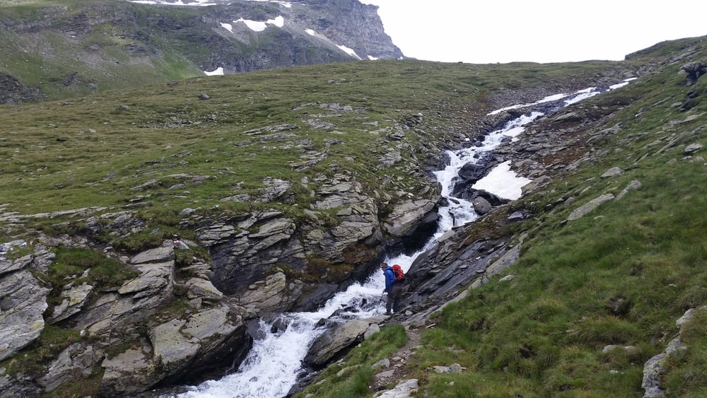
Defenitiv ein Erlebnis wert. Sehr schöne Landschaft.

Zum Ende der Wandertour hat alles aufgrund der Höhe schnell zur hoch Alpin Tour entwickelt... Schnee-Hagel etc...

Bei Wetter -Umschwung, jedoch nichts für schwache Nerven.

Jeder Zeit wieder.

Галерея маршрутов

Карта маршрута и высотный профиль

  • Open Street Map
  • Google
Minimum height 2323 m Maximum height 2888 m Детальный вид

More about the tour author

ThomasFalkenberg
Member since 2016

Send private message

Комментарии

GPS-Tracks

Trackpoints
  • GPX / Garmin Map Source (gpx) download
  • TCX / Garmin Training Center® (tcx) download
  • CRS / Garmin Training Center® (crs) download
  • Google Earth (kml) download
  • G7ToWin (g7t) download
  • TTQV (trk) download
  • Overlay (ovl) download
  • Fugawi (txt) download
  • Kompass (DAV) Track (tk) download
  • Формуляр маршрута (pdf) download
  • Original file of the author (gpx) download

More about the tour author

ThomasFalkenberg
Member since 2016

Send private message
Share track
Add to my favorites
Remove from my favorites
Edit tags
My score
Rate
Маршрут: Rudolfshütte > Sudetendeutsche Hütte
Вид: Горный маршрут
Длина: 13,2 km
Evaluated on:
Длительность:
Day(s)
Hour(s)
Minute(s)
Оценка: Ландшафт Веселье Кондиция Техника