Login

Забыл пароль?

Cookies have to be accepted!
Your browser's cookie functionality is disabled. Please enable this functionality.

Not a member yet?

Register now
Login

Available for registred users only

Log in to use this feature.

Забыл пароль?

Cookies have to be accepted!
Your browser's cookie functionality is disabled. Please enable this functionality.

Not a member yet?

Register now
Filter
Категории
Advanced filters
  • Длина (км)
  • Высотомер
Сохранить фильтр Reset filter

TrackRank

QRCode

Technical data

Длина4,9 km Высотомер574 m Way down577 m Длительность01:15 h:m Дата04.05.2017
Оценки Author Ландшафт Веселье Кондиция Техника

Статистика

302 Виды Оценки 44 Загрузки Среднее
Rate
  • Формуляр маршрута
  • Дорога
  • Загрузки

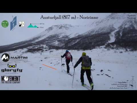
Genau an der Bezirksgrenze zieht eine Rinne empor. sie bietet eine Abfahrt in Idealneigung.

 Jahreszeit der Tour: Ende März

Галерея маршрутов

Карта маршрута и высотный профиль

  • Open Street Map
  • Google
Minimum height 228 m Maximum height 796 m Детальный вид

More about the tour author

Gi
Member since 2010

Send private message

Комментарии

Von Grenivik in Richtung Akureyri fahren, die erste Abzweigung nach links auf die 835 nehmen.

Nach dem Bach gibt es rechts eine Parkbucht. Hier starten


GPS-Tracks

Trackpoints
  • GPX / Garmin Map Source (gpx) download
  • TCX / Garmin Training Center® (tcx) download
  • CRS / Garmin Training Center® (crs) download
  • Google Earth (kml) download
  • G7ToWin (g7t) download
  • TTQV (trk) download
  • Overlay (ovl) download
  • Fugawi (txt) download
  • Kompass (DAV) Track (tk) download
  • Формуляр маршрута (pdf) download
  • Original file of the author (gpx) download

More about the tour author

Gi
Member since 2010

Send private message
Share track
Add to my favorites
Remove from my favorites
Edit tags
My score
Rate
Маршрут: Austurfiall
Вид: Лыжи
Длина: 4,9 km
Evaluated on:
Длительность:
Day(s)
Hour(s)
Minute(s)
Оценка: Ландшафт Веселье Кондиция Техника