Login

Забыл пароль?

Cookies have to be accepted!
Your browser's cookie functionality is disabled. Please enable this functionality.

Not a member yet?

Register now
Login

Available for registred users only

Log in to use this feature.

Забыл пароль?

Cookies have to be accepted!
Your browser's cookie functionality is disabled. Please enable this functionality.

Not a member yet?

Register now
Filter
Категории
Advanced filters
  • Длина (км)
  • Высотомер
Сохранить фильтр Reset filter

TrackRank

QRCode

Technical data

Длина10,4 km Высотомер830 m Way down822 m Длительность03:45 h:m Дата28.10.2017
Оценки Author Ландшафт Веселье Кондиция Техника

Статистика

656 Виды Оценки 13 Загрузки Среднее
Rate
  • Формуляр маршрута
  • Дорога
  • Загрузки
Vmes malo po svoje... Ponekod ni ravno najboljše označeno. Samotno. V dolini Sopote je vreden ogleda tudi slap Sušjek

Галерея маршрутов

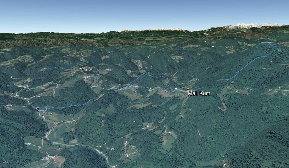
Карта маршрута и высотный профиль

  • Open Street Map
  • Google
Minimum height 504 m Maximum height 1218 m Детальный вид

More about the tour author

sandibor
Member since 2017

Send private message

Комментарии

Ljubljana-Litija-Polšnik-Sopota

Nazaj čez Veliko Presko

GPS-Tracks

Trackpoints
  • GPX / Garmin Map Source (gpx) download
  • TCX / Garmin Training Center® (tcx) download
  • CRS / Garmin Training Center® (crs) download
  • Google Earth (kml) download
  • G7ToWin (g7t) download
  • TTQV (trk) download
  • Overlay (ovl) download
  • Fugawi (txt) download
  • Kompass (DAV) Track (tk) download
  • Формуляр маршрута (pdf) download
  • Original file of the author (gpx) download

More about the tour author

sandibor
Member since 2017

Send private message
Share track
Add to my favorites
Remove from my favorites
Edit tags
My score
Rate
Маршрут: Sopota-Kum-Sopota (Nežina pot)
Вид: Горный маршрут
Длина: 10,4 km
Evaluated on:
Длительность:
Day(s)
Hour(s)
Minute(s)
Оценка: Ландшафт Веселье Кондиция Техника