Login

Забыл пароль?

Cookies have to be accepted!
Your browser's cookie functionality is disabled. Please enable this functionality.

Not a member yet?

Register now
Login

Available for registred users only

Log in to use this feature.

Забыл пароль?

Cookies have to be accepted!
Your browser's cookie functionality is disabled. Please enable this functionality.

Not a member yet?

Register now
Filter
Категории
Advanced filters
  • Длина (км)
  • Высотомер
Сохранить фильтр Reset filter

TrackRank

QRCode

Technical data

Длина11,5 km Высотомер1620 m Way down131 m Длительность00:00 h:m Дата04.12.2017
Оценки Author Ландшафт Веселье Кондиция Техника

Статистика

235 Виды Оценки 10 Загрузки Среднее
Rate
  • Формуляр маршрута
  • Дорога
  • Загрузки
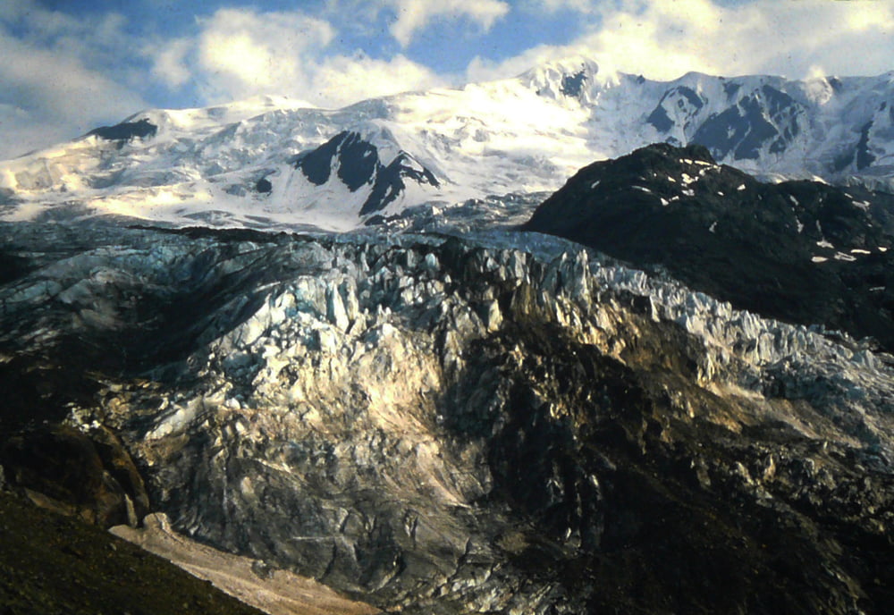
non raggiunto la vetta più  che altro è bello il ghiaccaio dei Forni da vedere  e il pernottamento al rif Branca fatto  nel 1986 quando il ghiacciaio era più grande 

Галерея маршрутов

Карта маршрута и высотный профиль

  • Open Street Map
  • Google
Minimum height 2171 m Maximum height 3661 m Детальный вид

More about the tour author

bettoliroberto
Member since 2010

Send private message

Комментарии

GPS-Tracks

Trackpoints
  • GPX / Garmin Map Source (gpx) download
  • TCX / Garmin Training Center® (tcx) download
  • CRS / Garmin Training Center® (crs) download
  • Google Earth (kml) download
  • G7ToWin (g7t) download
  • TTQV (trk) download
  • Overlay (ovl) download
  • Fugawi (txt) download
  • Kompass (DAV) Track (tk) download
  • Формуляр маршрута (pdf) download
  • Original file of the author (gpx) download

More about the tour author

bettoliroberto
Member since 2010

Send private message
Share track
Add to my favorites
Remove from my favorites
Edit tags
My score
Rate
Маршрут: Quasi punta San Matteo
Вид: Горный маршрут
Длина: 11,5 km
Evaluated on:
Длительность:
Day(s)
Hour(s)
Minute(s)
Оценка: Ландшафт Веселье Кондиция Техника