Login

Забыл пароль?

Cookies have to be accepted!
Your browser's cookie functionality is disabled. Please enable this functionality.

Not a member yet?

Register now
Login

Available for registred users only

Log in to use this feature.

Забыл пароль?

Cookies have to be accepted!
Your browser's cookie functionality is disabled. Please enable this functionality.

Not a member yet?

Register now
Filter
Категории
Advanced filters
  • Длина (км)
  • Высотомер
Сохранить фильтр Reset filter

TrackRank

QRCode

Technical data

Длина13,3 km Высотомер513 m Way down491 m Длительность01:50 h:m Дата01.05.2018
Оценки Author Ландшафт Веселье Кондиция Техника

Статистика

172 Виды Оценки 44 Загрузки Среднее
Rate
  • Формуляр маршрута
  • Дорога
  • Загрузки

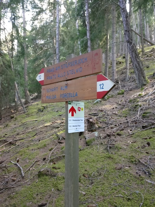
Von Prad aus geht es erst einmal über Agums nach Lichtenberg. Ab hier schrauben wir uns hoch zum Einstieg des Trails.

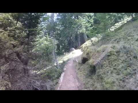
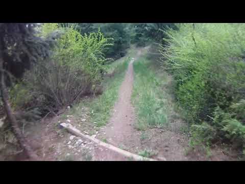
Hier erwartet uns ein wurzeldurchzogener schmaler Singletrail der einfach nur geil ist....

Auf Wanderer Rücksicht nehmen ist natürlich obligatorisch!!!

Viel Spaß

Галерея маршрутов

Карта маршрута и высотный профиль

  • Open Street Map
  • Google
Minimum height 892 m Maximum height 1402 m Детальный вид

More about the tour author

volker67
Member since 2010

Send private message

Комментарии

GPS-Tracks

Trackpoints
  • GPX / Garmin Map Source (gpx) download
  • TCX / Garmin Training Center® (tcx) download
  • CRS / Garmin Training Center® (crs) download
  • Google Earth (kml) download
  • G7ToWin (g7t) download
  • TTQV (trk) download
  • Overlay (ovl) download
  • Fugawi (txt) download
  • Kompass (DAV) Track (tk) download
  • Формуляр маршрута (pdf) download
  • Original file of the author (gpx) download

More about the tour author

volker67
Member since 2010

Send private message
Share track
Add to my favorites
Remove from my favorites
Edit tags
My score
Rate
Маршрут: Plankamoudi-Trail
Вид: Горный велосипед
Длина: 13,3 km
Evaluated on:
Длительность:
Day(s)
Hour(s)
Minute(s)
Оценка: Ландшафт Веселье Кондиция Техника