
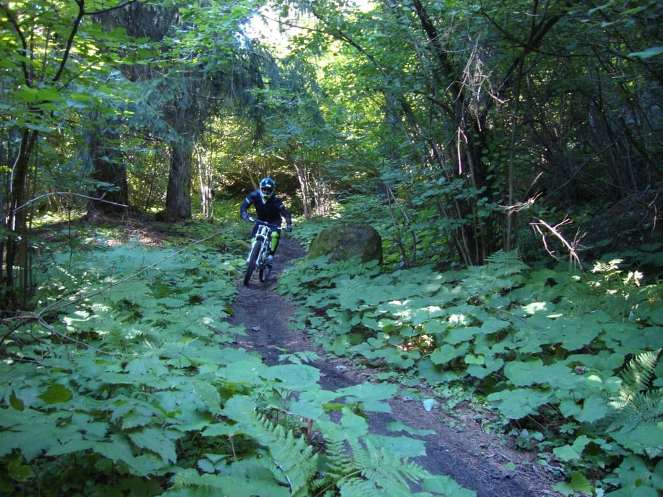

Single track molto divertente lungo e vario da percorrere con bike enduro o downhill.
Lungo La Preda potrete mettere alla prova le vostre tecniche discesistiche a bordo delle vostre bike. Il percorso presenta vari tipi di terreno: scorrevole, radici, sassi, pendenza, appoggi, gobbe sui quali potrete volare su due ruote. Risalita con telecabina Daolasa a Commezzadura.
Dall'arrivo della telecabina di Daolasa si imbocca subito un single track che affianca in discesa la strada forestale che porta al Malghet Aut. Si segue poi la forestale in direzione Malga di Dimaro. Prima della Malga un bivio sulla sinistra ci porta in una strada stretta che diventa un divertente sentiero fino ad incrociare una pista da sci. Non si segue la pista ma si prende un altro tecnico sentiero nel bosco. Il sentiero entra infine nella pista da sci che si segue fino alla Località Belvedere di Folgarida. Un minuto di calma sull'asfalto della statale e dopo l'Albergo Belvedere si imbocca la strada sterrata e subito dopo sulla sinistra inizia il sentiero "La Preda del Pè". Il sentiero è tecnico con radici, fango, sassi, salti, curve secche e curve veloci. Dopo una bella discesa si imbocca sulla sinistra un sentiero pianeggiante (lec) che ci porta al tornante della statale per Campiglio. Si prende il bivio per Costa Rotian. Breve tratto in asfalto, seguito da una stradina sterrata e di nuovo un tratto in asfalto ci conducono senza difficoltà al Parcheggio di Daolasa.
Further information at
http://www.campigliodolomiti.it/biketracksГалерея маршрутов

Карта маршрута и высотный профиль
Minimum height 810 m
Maximum height 2039 m
More about the tour author

|
Dolomeet |
Комментарии

GPS-Tracks
Trackpoints-
GPX / Garmin Map Source (gpx) download
-
TCX / Garmin Training Center® (tcx) download
-
CRS / Garmin Training Center® (crs) download
-
Google Earth (kml) download
-
G7ToWin (g7t) download
-
TTQV (trk) download
-
Overlay (ovl) download
-
Fugawi (txt) download
-
Kompass (DAV) Track (tk) download
-
Формуляр маршрута (pdf) download
-
Original file of the author (gpx) download
More about the tour author
|
|
Dolomeet |
Add to my favorites
Remove from my favorites
Edit tags
Open track
My score
Rate