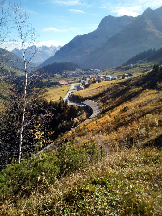
Login

Забыл пароль?

Cookies have to be accepted!
Your browser's cookie functionality is disabled. Please enable this functionality.

Not a member yet?

Register now
Login

Available for registred users only

Log in to use this feature.

Забыл пароль?

Cookies have to be accepted!
Your browser's cookie functionality is disabled. Please enable this functionality.

Not a member yet?

Register now
Filter
Категории
Advanced filters
  • Длина (км)
  • Высотомер
Сохранить фильтр Reset filter

TrackRank

QRCode

Technical data

Длина90,3 km Высотомер2648 m Way down2500 m Длительность1 day 0 h Дата27.11.2018
Оценки Author Ландшафт Веселье Кондиция Техника

Статистика

862 Виды Оценки 137 Загрузки Среднее
Rate
  • Формуляр маршрута
  • Дорога
  • Загрузки

Sehr schöne Tour ,

die im Herbst gefahren wurde. (Goldener Oktober)

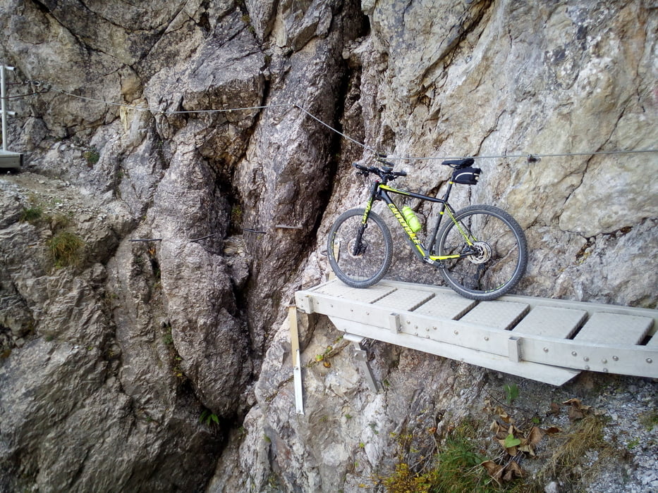
Steg am Schrofenpass war bereits abgebaut.

Konditionell herausfordernd.

Nicht unbedingt E-Bike tauglich, da schwierige

Schiebe-Tragestücke  (Schrofenpass) dabei sind.

Галерея маршрутов

Карта маршрута и высотный профиль

  • Open Street Map
  • Google
Minimum height 700 m Maximum height 1795 m Детальный вид

More about the tour author

josy
Member since 2009

Send private message

Комментарии

Start bei Tiefenbach vor Oberstdorf,

Parkmöglichkeit für PKW.

GPS-Tracks

Trackpoints
  • GPX / Garmin Map Source (gpx) download
  • TCX / Garmin Training Center® (tcx) download
  • CRS / Garmin Training Center® (crs) download
  • Google Earth (kml) download
  • G7ToWin (g7t) download
  • TTQV (trk) download
  • Overlay (ovl) download
  • Fugawi (txt) download
  • Kompass (DAV) Track (tk) download
  • Формуляр маршрута (pdf) download
  • Original file of the author (gpx) download

More about the tour author

josy
Member since 2009

Send private message
Share track
Add to my favorites
Remove from my favorites
Edit tags
My score
Rate
Маршрут: Oberstdorf-Lechtal
Вид: Горный велосипед
Длина: 90,3 km
Evaluated on:
Длительность:
Day(s)
Hour(s)
Minute(s)
Оценка: Ландшафт Веселье Кондиция Техника