Login

Забыл пароль?

Cookies have to be accepted!
Your browser's cookie functionality is disabled. Please enable this functionality.

Not a member yet?

Register now
Login

Available for registred users only

Log in to use this feature.

Забыл пароль?

Cookies have to be accepted!
Your browser's cookie functionality is disabled. Please enable this functionality.

Not a member yet?

Register now
Filter
Категории
Advanced filters
  • Длина (км)
  • Высотомер
Сохранить фильтр Reset filter

TrackRank

QRCode

Technical data

Длина10,3 km Высотомер394 m Way down442 m Длительность03:00 h:m Дата15.09.2019
Оценки Author Ландшафт Веселье Кондиция Техника

Статистика

137 Виды Оценки 5 Загрузки Среднее
Rate
  • Формуляр маршрута
  • Дорога
  • Загрузки

Gemütliche Familienwanderung von der Roßtratte aus - bis dorthin auf der Mautstrassse mit PKW.

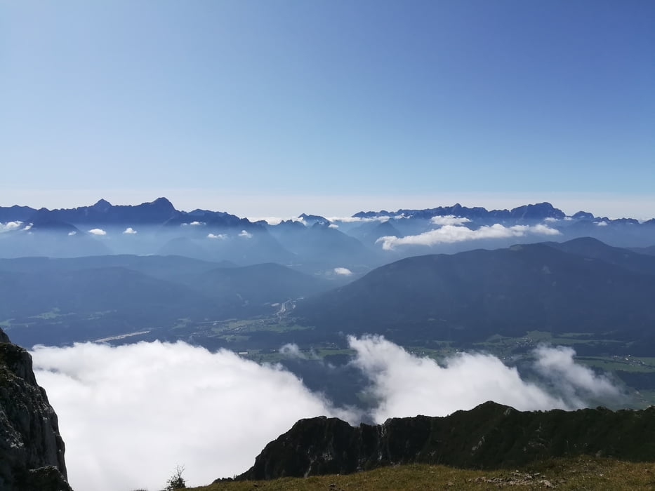
Herrliche Aussicht in die Julischen Alpen und das gesamte Kärntner Gebirgspanorama.

Галерея маршрутов

Карта маршрута и высотный профиль

  • Open Street Map
  • Google
Minimum height 1608 m Maximum height 2160 m Детальный вид

More about the tour author

walderich
Member since 2012

Send private message

Комментарии

GPS-Tracks

Trackpoints
  • GPX / Garmin Map Source (gpx) download
  • TCX / Garmin Training Center® (tcx) download
  • CRS / Garmin Training Center® (crs) download
  • Google Earth (kml) download
  • G7ToWin (g7t) download
  • TTQV (trk) download
  • Overlay (ovl) download
  • Fugawi (txt) download
  • Kompass (DAV) Track (tk) download
  • Формуляр маршрута (pdf) download
  • Original file of the author (gpx) download

More about the tour author

walderich
Member since 2012

Send private message
Share track
Add to my favorites
Remove from my favorites
Edit tags
My score
Rate
Маршрут: Dobratschgipfel von der Roßtratte aus
Вид: Пешеходный туризм
Длина: 10,3 km
Evaluated on:
Длительность:
Day(s)
Hour(s)
Minute(s)
Оценка: Ландшафт Веселье Кондиция Техника