


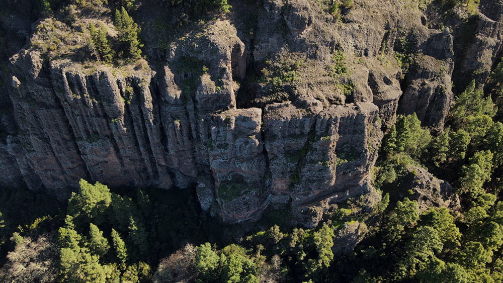
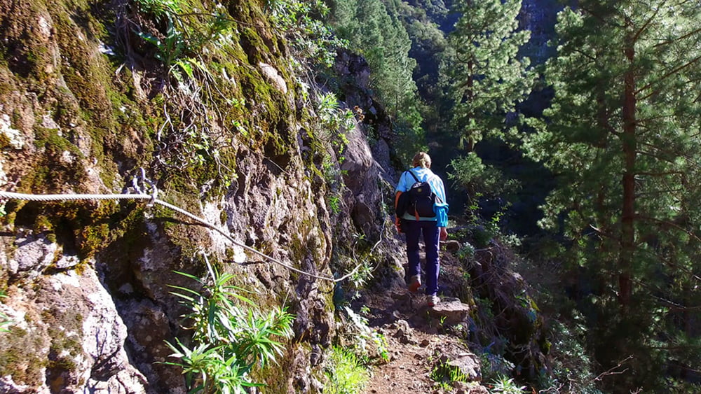
Spektakuläre Runde um die »Orgelpfeifen« Diese wildromantische Höhenwanderung bietet ein abwechslungsreiches, hin und wieder gar spektakuläres Bergvergnügen: Sie führt mitten hinein in die Schluchten- und Felsenwelt oberhalb der berühmten Orgelpfeifen und beschert uns prachtvolle Ausblicke auf das Orotava-Tal und den Teide. Zuerst senkt sich der Wanderweg leicht, dann geht es stetig Bergan bis zum Höchsten Punkt, ab dort ist die Tendenz zum Ziel fallend.
Галерея маршрутов


Карта маршрута и высотный профиль
Minimum height 1143 m
Maximum height 1572 m
More about the tour author
|
|
schleidy |
Комментарии

GPS-Tracks
Trackpoints-
GPX / Garmin Map Source (gpx) download
-
TCX / Garmin Training Center® (tcx) download
-
CRS / Garmin Training Center® (crs) download
-
Google Earth (kml) download
-
G7ToWin (g7t) download
-
TTQV (trk) download
-
Overlay (ovl) download
-
Fugawi (txt) download
-
Kompass (DAV) Track (tk) download
-
Формуляр маршрута (pdf) download
-
Original file of the author (gpx) download
More about the tour author
|
|
schleidy |
Add to my favorites
Remove from my favorites
Edit tags
Open track
My score
Rate