
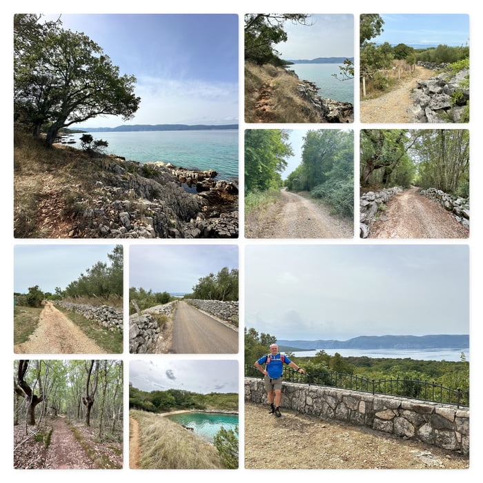

Meine Wanderung beginnt an der Küste etwas oberhalb von Porat.
Ich folge dem schmalen Pfad, der direkt an der Küste entlang führt.
Als nächstes Ziel gehe ich zum Fumak (61m). Ich umrunde das Denkmal und folge nun der Schotterstraße ins Landesinnere und dann Richtung Porat zurück.
Weiter geht es entlang der Olivenhaine bis zum Meer und nun wieder an der Küste folgend retour zu meinem Ausgangspunkt.
Further information at
https://www.bergfex.at/sommer/insel-krk/touren/wandern/Карта маршрута и высотный профиль
Minimum height 2 m
Maximum height 82 m
More about the tour author
|
|
huberj59 |
Комментарии

Feriendomizil: Villa for rent Croatia, Holiday Vacation Villa Rental, Malinska, island Krk (villatonka.com)
Zu unserem Ferienhaus gehört auch ein wunderbares Meergrundstück. Von dort startet meine Wanderung.
Koordinaten: N45° 07' 36.5" E14° 28' 42.2"
Tipp: Besuchen Sie den Olivenhain & probieren Sie die Krk-Olivenöle (mare-vrbnik.com)
GPS-Tracks
Trackpoints-
GPX / Garmin Map Source (gpx) download
-
TCX / Garmin Training Center® (tcx) download
-
CRS / Garmin Training Center® (crs) download
-
Google Earth (kml) download
-
G7ToWin (g7t) download
-
TTQV (trk) download
-
Overlay (ovl) download
-
Fugawi (txt) download
-
Kompass (DAV) Track (tk) download
-
Формуляр маршрута (pdf) download
-
Original file of the author (gpx) download
More about the tour author
|
|
huberj59 |
Add to my favorites
Remove from my favorites
Edit tags
Open track
My score
Rate