Login

Забыл пароль?

Cookies have to be accepted!
Your browser's cookie functionality is disabled. Please enable this functionality.

Not a member yet?

Register now
Login

Available for registred users only

Log in to use this feature.

Забыл пароль?

Cookies have to be accepted!
Your browser's cookie functionality is disabled. Please enable this functionality.

Not a member yet?

Register now
Filter
Категории
Advanced filters
  • Длина (км)
  • Высотомер
Сохранить фильтр Reset filter

TrackRank

QRCode

Technical data

Длина13,8 km Высотомер207 m Way down228 m Длительность00:00 h:m Дата08.07.2008
Оценки Author Ландшафт Веселье Кондиция Техника

Статистика

4655 Виды Оценки 147 Загрузки Среднее
Rate
  • Формуляр маршрута
  • Дорога
  • Загрузки

Wanderung auf einem Teilstück des Jakobsweges von Hohenpeißenberg nach Rottenbuch.

Ziel ist der Klosterhof von Rottenbuch.

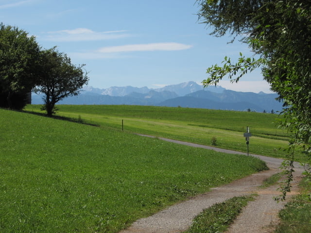
Sehr schöne Wanderung durchs herrliche Ammertal auf einem tollen Pfad über Brücken und Holzstege.

Галерея маршрутов

Карта маршрута и высотный профиль

  • Open Street Map
  • Google
Minimum height 682 m Maximum height 796 m Детальный вид

More about the tour author

Ritzelflitzer
Member since 2008

Send private message

Комментарии

GPS-Tracks

Trackpoints
  • GPX / Garmin Map Source (gpx) download
  • TCX / Garmin Training Center® (tcx) download
  • CRS / Garmin Training Center® (crs) download
  • Google Earth (kml) download
  • G7ToWin (g7t) download
  • TTQV (trk) download
  • Overlay (ovl) download
  • Fugawi (txt) download
  • Kompass (DAV) Track (tk) download
  • Формуляр маршрута (pdf) download
  • Original file of the author (gpx) download

More about the tour author

Ritzelflitzer
Member since 2008

Send private message
Share track
Add to my favorites
Remove from my favorites
Edit tags
My score
Rate
Маршрут: Teil vom Jakobsweg von Hohenpeißenberg nach Rottenbuch durch die Ammerschlucht
Вид: Пешеходный туризм
Длина: 13,8 km
Evaluated on:
Длительность:
Day(s)
Hour(s)
Minute(s)
Оценка: Ландшафт Веселье Кондиция Техника