Login

Забыл пароль?

Cookies have to be accepted!
Your browser's cookie functionality is disabled. Please enable this functionality.

Not a member yet?

Register now
Login

Available for registred users only

Log in to use this feature.

Забыл пароль?

Cookies have to be accepted!
Your browser's cookie functionality is disabled. Please enable this functionality.

Not a member yet?

Register now
Filter
Категории
Advanced filters
  • Длина (км)
  • Высотомер
Сохранить фильтр Reset filter

TrackRank

QRCode

Technical data

Длина255,0 km Высотомер3664 m Way down3607 m Длительность00:00 h:m Дата04.08.2008
Оценки Author Ландшафт Веселье Кондиция Техника

Статистика

3326 Виды Оценки 517 Загрузки Среднее
Rate
  • Формуляр маршрута
  • Дорога
  • Загрузки

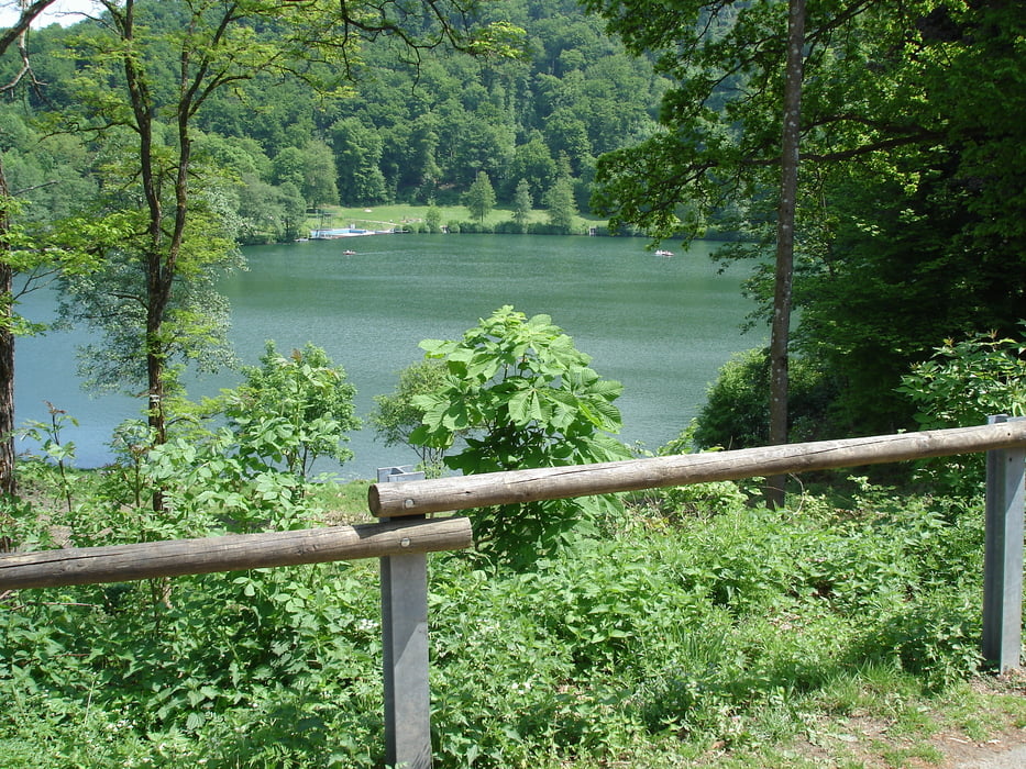
Eine schöne Rundtour durch die Eifellandschaft. Ein Stopp lohnt am Gmündner Maar mit Café und am Motorradtreffpunkt in Cochem unter der Moselbrücke.

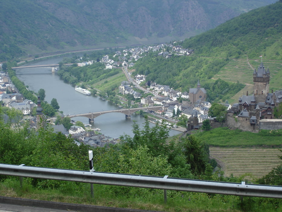
Oberhalb von Cochem ein Abstecher zu einem Parkplatz mit wunderbarem Blick auf die Stadt und das Moseltal.

Галерея маршрутов

Карта маршрута и высотный профиль

  • Open Street Map
  • Google
Minimum height 55 m Maximum height 579 m Детальный вид

More about the tour author

f650gs
Member since 2008

Send private message

Комментарии

GPS-Tracks

Trackpoints
  • GPX / Garmin Map Source (gpx) download
  • TCX / Garmin Training Center® (tcx) download
  • CRS / Garmin Training Center® (crs) download
  • Google Earth (kml) download
  • G7ToWin (g7t) download
  • TTQV (trk) download
  • Overlay (ovl) download
  • Fugawi (txt) download
  • Kompass (DAV) Track (tk) download
  • Формуляр маршрута (pdf) download
  • Original file of the author (gpx) download

More about the tour author

f650gs
Member since 2008

Send private message
Share track
Add to my favorites
Remove from my favorites
Edit tags
My score
Rate
Маршрут: Von der Mosel in die Eifel
Вид: Мотоцикл
Длина: 255,0 km
Evaluated on:
Длительность:
Day(s)
Hour(s)
Minute(s)
Оценка: Ландшафт Веселье Кондиция Техника