


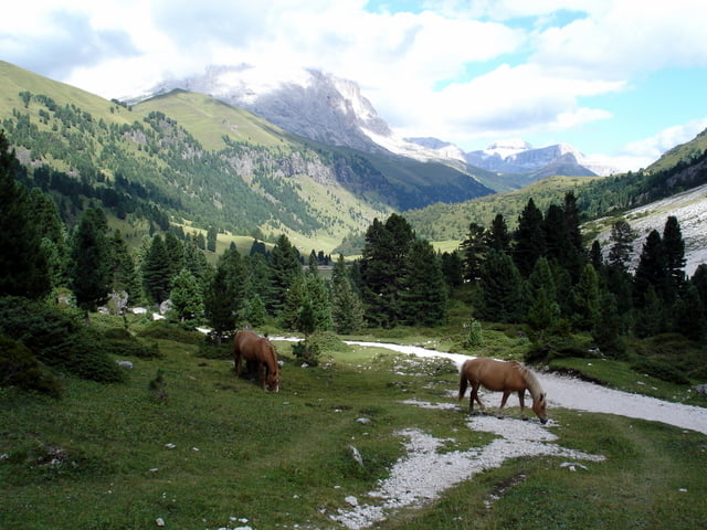
Giro panoramico fantastico che ci porta nella Val Duron, una delle valli più suggestive ed intatte delle Dolomiti, incuneata fra il Sassopiatto ed il gruppo del Catinaccio. Partendo da Selva si raggiunge il Passo Sella da dove, con una bella e facile discesa, si raggiunge Canazei. Da Campitello di Fassa si risale poi la Val Duron fino al Passo Duron ed attraverso i magnifici saliscendi dell’Alpe di Siusi si ritorna a Selva in Valgardena.
Further information at
http://www.sibillini-mtb.itГалерея маршрутов


Карта маршрута и высотный профиль
Minimum height 1416 m
Maximum height 2251 m
More about the tour author
|
|
barbonis |
Комментарии
GPS-Tracks
Trackpoints-
GPX / Garmin Map Source (gpx) download
-
TCX / Garmin Training Center® (tcx) download
-
CRS / Garmin Training Center® (crs) download
-
Google Earth (kml) download
-
G7ToWin (g7t) download
-
TTQV (trk) download
-
Overlay (ovl) download
-
Fugawi (txt) download
-
Kompass (DAV) Track (tk) download
-
Формуляр маршрута (pdf) download
-
Original file of the author (gpx) download
More about the tour author
|
|
barbonis |
Add to my favorites
Remove from my favorites
Edit tags
Open track
My score
Rate
Die Tour ist in jeder Hinsicht ein Traum.
http://www.singletrail-skala.de/