

Immer dem Tal entlang nicht sonderlich Steil bis zur Kemater Alm.
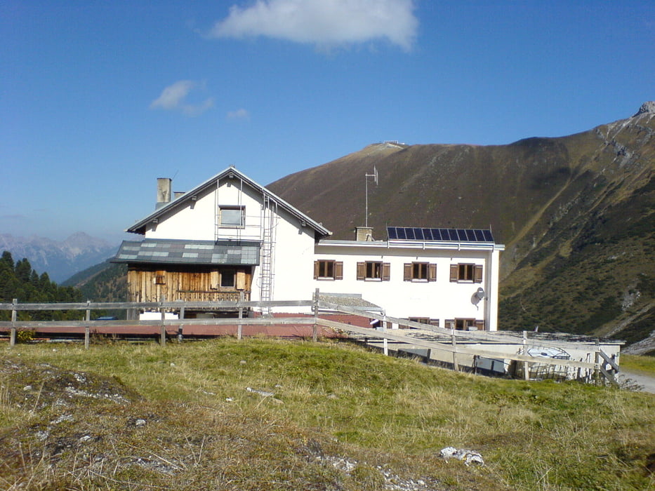
Aber dannnnnnnnnnnnnn, Mehrere Anstiege die es in sich haben. Auf der Hütte kann man das herrliche Panorama geniesen
Aber dannnnnnnnnnnnnn, Mehrere Anstiege die es in sich haben. Auf der Hütte kann man das herrliche Panorama geniesen
Галерея маршрутов
Карта маршрута и высотный профиль
Minimum height 941 m
Maximum height 1997 m
More about the tour author
|
|
tomi |
Комментарии

Von Innsbruck nach Axams und weiter nach Grinsens. Dort gibts bei einem M-Preis einen schönen Parkplatz wo man mit dem Bike Startet
GPS-Tracks
Trackpoints-
GPX / Garmin Map Source (gpx) download
-
TCX / Garmin Training Center® (tcx) download
-
CRS / Garmin Training Center® (crs) download
-
Google Earth (kml) download
-
G7ToWin (g7t) download
-
TTQV (trk) download
-
Overlay (ovl) download
-
Fugawi (txt) download
-
Kompass (DAV) Track (tk) download
-
Формуляр маршрута (pdf) download
-
Original file of the author (gpx) download
More about the tour author
|
|
tomi |
Add to my favorites
Remove from my favorites
Edit tags
Open track
My score
Rate