
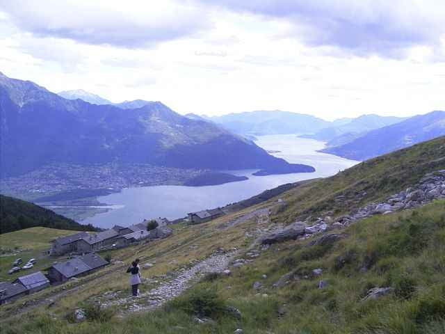

Tour von Gera Lario auf den Paß beim Mt. Berlinghera. In dem Örtchen vor dem Paß kann man das Rad stehen lassen und die letzten 50hm zum Paß hochlaufen. Die Abfahrt ist gut fahrbar bis San Bartholomo. Dem normalen Fahrer empfehle ich dann die Auffahrt auf der Teerstraße bis Dolo nach Sorico.
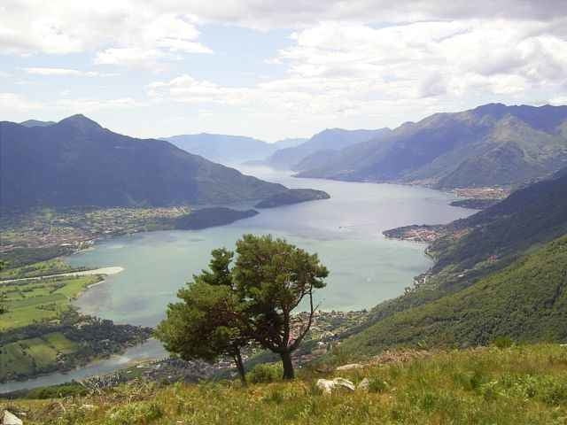
Für Hardcore Freunde ist die Abfahrt auf dem VML Wanderweg das richtige. Man muß zwar öfter absteigen und die Hindernisse sind zahlreich, der VML Weg ist aber eine echte Herausforderung.
Ich wollte eigentlich am Paß auf der Rückseite herunter fahren..., das nächste Mal.
Für Hardcore Freunde ist die Abfahrt auf dem VML Wanderweg das richtige. Man muß zwar öfter absteigen und die Hindernisse sind zahlreich, der VML Weg ist aber eine echte Herausforderung.
Ich wollte eigentlich am Paß auf der Rückseite herunter fahren..., das nächste Mal.
Галерея маршрутов
Карта маршрута и высотный профиль
Minimum height 189 m
Maximum height 1671 m
More about the tour author
|
|
skyhopper |
Комментарии

From Chur coming go direction San Bernardino, at Splügen go right to passo de Splügen and from there to the lago di Como (Lario). Here right direction to Lugano (not Lecco).
Parken an der Kirche in Gera Lario (gratis).
Parken an der Kirche in Gera Lario (gratis).
GPS-Tracks
Trackpoints-
GPX / Garmin Map Source (gpx) download
-
TCX / Garmin Training Center® (tcx) download
-
CRS / Garmin Training Center® (crs) download
-
Google Earth (kml) download
-
G7ToWin (g7t) download
-
TTQV (trk) download
-
Overlay (ovl) download
-
Fugawi (txt) download
-
Kompass (DAV) Track (tk) download
-
Формуляр маршрута (pdf) download
-
Original file of the author (gpx) download
More about the tour author
|
|
skyhopper |
Add to my favorites
Remove from my favorites
Edit tags
Open track
My score
Rate