


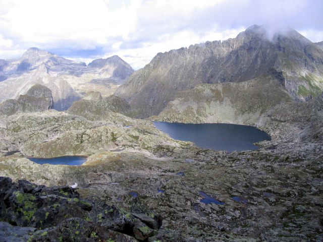
Eine landschaftlich sehr schöne Tour in den Schladminger Tauern.
Der Klafferkessel ist mit seinen vielen Seen sicherlich ein sehr attraktives Ziel.
Die gesamte Tour in einem Tag zu machen ist sicherlich etwas viel, es bietet sich eine Übernachtung in der Preintaler- oder in der Gollinghütte an.
Der Klafferkessel ist mit seinen vielen Seen sicherlich ein sehr attraktives Ziel.
Die gesamte Tour in einem Tag zu machen ist sicherlich etwas viel, es bietet sich eine Übernachtung in der Preintaler- oder in der Gollinghütte an.
Further information at
http://preintaler.at/preintaler/touren/klaffer.phpГалерея маршрутов
Карта маршрута и высотный профиль
Minimum height 922 m
Maximum height 2605 m
More about the tour author
|
|
PeterH |
Комментарии

B 320 nach Schladming, von Schladming Richtung Süden nach Rohrmoos, nach etwa 5 km beim Kreisverkehr Richtung Untertal, das Untertal bis zum Parkplatz Riesachfall entlang fahren (Ende der Strasse)
GPS-Tracks
Trackpoints-
GPX / Garmin Map Source (gpx) download
-
TCX / Garmin Training Center® (tcx) download
-
CRS / Garmin Training Center® (crs) download
-
Google Earth (kml) download
-
G7ToWin (g7t) download
-
TTQV (trk) download
-
Overlay (ovl) download
-
Fugawi (txt) download
-
Kompass (DAV) Track (tk) download
-
Формуляр маршрута (pdf) download
-
Original file of the author (gpx) download
More about the tour author
|
|
PeterH |
Add to my favorites
Remove from my favorites
Edit tags
Open track
My score
Rate