


Entlang des Forstweges bis zur Grünwaldkaralm, entlang eines fast nicht erkennbaren Steiges zum Gipfel. Man sagt man soll sich hier vor Schlangen in Acht nehmen...
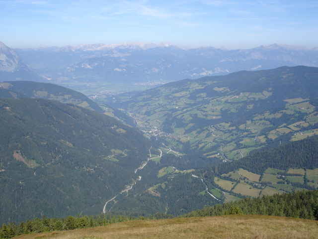
Der Ausblick ins Donnersbachtal ist hervorragend!
Zurück geht man den gleichen Weg.
Der Ausblick ins Donnersbachtal ist hervorragend!
Zurück geht man den gleichen Weg.
Further information at
http://www.donnersbach.atГалерея маршрутов
Карта маршрута и высотный профиль
Minimum height 1011 m
Maximum height 1904 m
More about the tour author

|
Комментарии

N47 26.019 E14 09.294
GPS-Tracks
Trackpoints-
GPX / Garmin Map Source (gpx) download
-
TCX / Garmin Training Center® (tcx) download
-
CRS / Garmin Training Center® (crs) download
-
Google Earth (kml) download
-
G7ToWin (g7t) download
-
TTQV (trk) download
-
Overlay (ovl) download
-
Fugawi (txt) download
-
Kompass (DAV) Track (tk) download
-
Формуляр маршрута (pdf) download
More about the tour author
|
|
Add to my favorites
Remove from my favorites
Edit tags
Open track
My score
Rate