Login

Забыл пароль?

Cookies have to be accepted!
Your browser's cookie functionality is disabled. Please enable this functionality.

Not a member yet?

Register now
Login

Available for registred users only

Log in to use this feature.

Забыл пароль?

Cookies have to be accepted!
Your browser's cookie functionality is disabled. Please enable this functionality.

Not a member yet?

Register now
Filter
Категории
Advanced filters
  • Длина (км)
  • Высотомер
Сохранить фильтр Reset filter

TrackRank

QRCode

Technical data

Длина12,2 km Высотомер410 m Way down413 m Длительность05:00 h:m Дата03.05.2009
Оценки Author User Ландшафт Веселье Кондиция Техника

Статистика

1668 Виды 1 Оценка 566 Загрузки 4.00 Среднее
Rate
  • Формуляр маршрута
  • Дорога
  • Загрузки
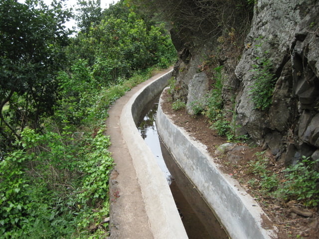
Levadawanderung auf 400 m NN. mit Auf- und Abstieg auf schmalen, steilen Strassen und Stufen bis zum  Meer.

Галерея маршрутов

Карта маршрута и высотный профиль

  • Open Street Map
  • Google
Minimum height 19 m Maximum height 411 m Детальный вид

More about the tour author

Heihopser
Member since 2009

Send private message

Комментарии

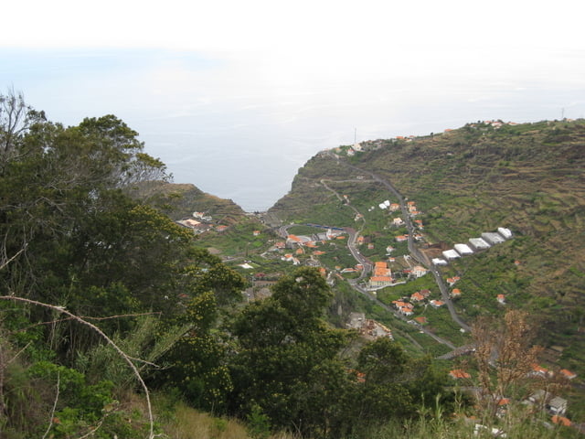
Wir parken auf dem Seitenstreifen auf der von Tabua in Tal führenden Strasse und beginnen die Tour mit dem Abstieg ins Tal

GPS-Tracks

Trackpoints
  • GPX / Garmin Map Source (gpx) download
  • TCX / Garmin Training Center® (tcx) download
  • CRS / Garmin Training Center® (crs) download
  • Google Earth (kml) download
  • G7ToWin (g7t) download
  • TTQV (trk) download
  • Overlay (ovl) download
  • Fugawi (txt) download
  • Kompass (DAV) Track (tk) download
  • Формуляр маршрута (pdf) download
  • Original file of the author (gpx) download

More about the tour author

Heihopser
Member since 2009

Send private message
Share track
Add to my favorites
Remove from my favorites
Edit tags
My score
Rate
Маршрут: Rundweg durch das Tal der Tabua
Вид: Пешеходный туризм
Длина: 12,2 km
Evaluated on:
Длительность:
Day(s)
Hour(s)
Minute(s)
Оценка: Ландшафт Веселье Кондиция Техника