Login

Забыл пароль?

Cookies have to be accepted!
Your browser's cookie functionality is disabled. Please enable this functionality.

Not a member yet?

Register now
Login

Available for registred users only

Log in to use this feature.

Забыл пароль?

Cookies have to be accepted!
Your browser's cookie functionality is disabled. Please enable this functionality.

Not a member yet?

Register now
Filter
Категории
Advanced filters
  • Длина (км)
  • Высотомер
Сохранить фильтр Reset filter

TrackRank

QRCode

Technical data

Длина38,1 km Высотомер1042 m Way down1072 m Длительность00:00 h:m Дата09.05.2009
Оценки Author Ландшафт Веселье Кондиция Техника

Статистика

78 Виды Оценки 66 Загрузки Среднее
Rate
  • Формуляр маршрута
  • Дорога
  • Загрузки
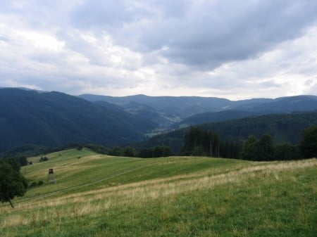
Trasa vede nad údolím Lomné po traverzových lesních cestách s minimem asfaltu (ca10%).

Карта маршрута и высотный профиль

  • Open Street Map
  • Google
Minimum height 456 m Maximum height 911 m Детальный вид

More about the tour author

Petrk
Member since 2009

Send private message

Комментарии

Autem do Dolní Lomné. Na začátku obce parkoviště u restaurace Mánes

GPS-Tracks

Trackpoints
  • GPX / Garmin Map Source (gpx) download
  • TCX / Garmin Training Center® (tcx) download
  • CRS / Garmin Training Center® (crs) download
  • Google Earth (kml) download
  • G7ToWin (g7t) download
  • TTQV (trk) download
  • Overlay (ovl) download
  • Fugawi (txt) download
  • Kompass (DAV) Track (tk) download
  • Формуляр маршрута (pdf) download
  • Original file of the author (gpx) download

More about the tour author

Petrk
Member since 2009

Send private message
Share track
Add to my favorites
Remove from my favorites
Edit tags
My score
Rate
Маршрут: Nad údolím Lomné
Вид: Горный велосипед
Длина: 38,1 km
Evaluated on:
Длительность:
Day(s)
Hour(s)
Minute(s)
Оценка: Ландшафт Веселье Кондиция Техника